Eleven motivated participants. A Flying Sensor. A challenging task to perform. Perfect facilities (Thank you Mr Isaac Duodu from Kumasi Business Incubator!). The right assistance (Mr Joel Budu from Farmerline!). That’s what it takes to perform a week’s training and finish it successfully.
Coming from different professional backgrounds most of the trainees did not know each other at the beginning. And that counts for me, the trainer, as well. At the end of the week, it felt like we were a group. Everybody going his or her own way again, but now with common experiences: piloting a drone, or a Flying Sensor (FS), as our TWIGA consortium FutureWater-HiView has doped it, and processing the images that come from the FSs.
So everything went well? No incidents? No crashes? Nobody absent for a longer time? Well… we had a leakage in the classroom – a room in the venue at the KNUST University – but our host Isaac got rid of that small inconvenience. And there was a power cut… And there was some noise from construction works on the venue building being renovated, but no major issues. So apart from some minor setbacks, we had a very good and productive week.
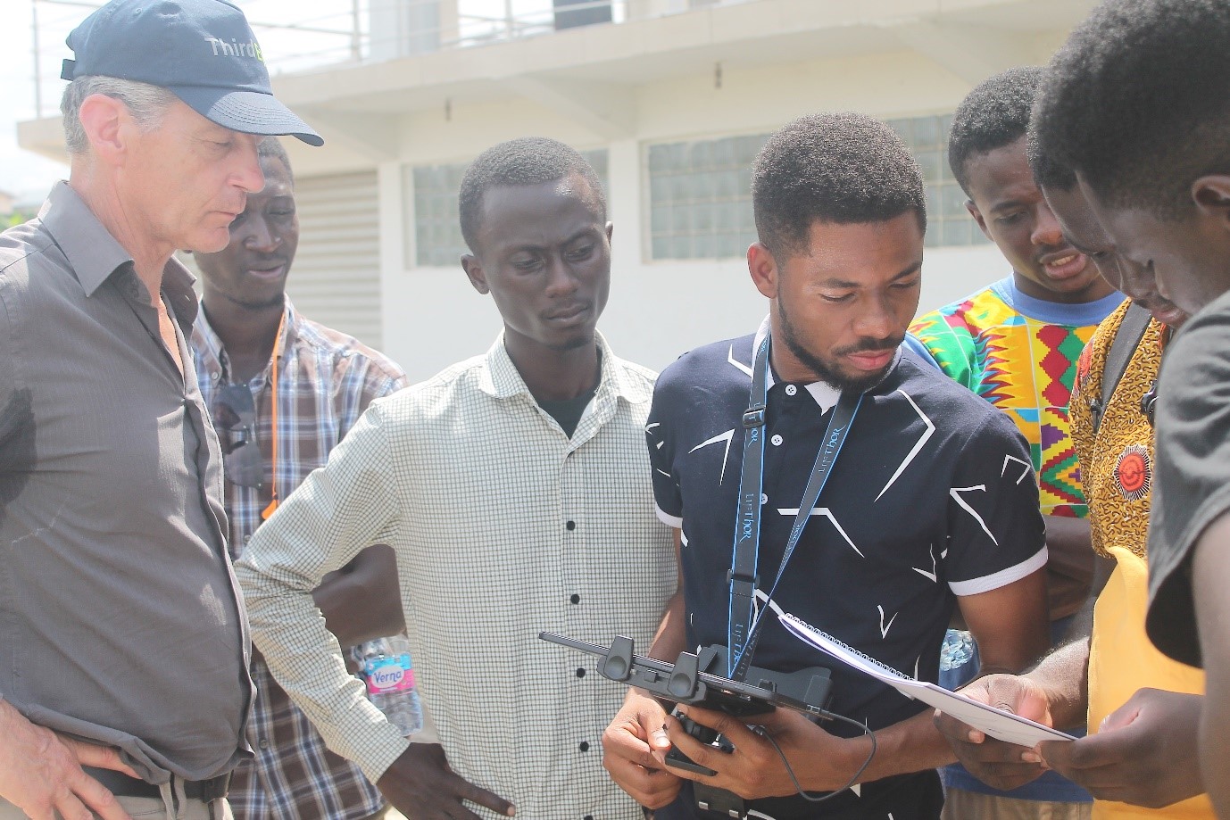
Starting on Friday the 23th of November, ending on Thursday 29th. There was quite a list of activities that were to be trained. There was a good balance between indoors and outdoors. We pas142sed 3 days (partly) outside. It started on Friday, after the introduction in the venue, when we practiced manual pilot skills at the athletics court of the KNUST University. On Monday the automatic flying of the drone was on the program. The rehearsing of automatic flights was done on Tuesday and Wednesday. This took place at different spots in the previously identified area of interest, which was in the surroundings of Lake Road Bridge and the Agogo market, in Kumasi. In between the outdoors activities and on the final day, Thursday, the processing of the images from the FSs was on the program. The FS that was disposable had three different cameras: RGB (Red Green Blue, that is the normal visual cam), NIR (Near InfraRed) and IR (thermal).
The processing of the images derived from the three different cams resulted in producing geo-referenced orthomosaics and NDVI maps. With the help of such overviewing maps it is possible to detect crop stress, but also, more relevant in the urban situation, plastic waste or the watercourse in canals or rivers.
At FutureWater in Wageningen and at the TU Delft the in-depth interpretation of the aerial footage will take place, but in our classroom, the participants learned to deliver processing results within a week. In a way, I think this a good example of bridging the gap between scientific treatment and the first in-field treatment of the data and showing that both stages are needed and useful. Personnel on the ground should dispose of basic knowledge of the data quality and the possible applications in order to communicate about it with either clients or experts at the same time.
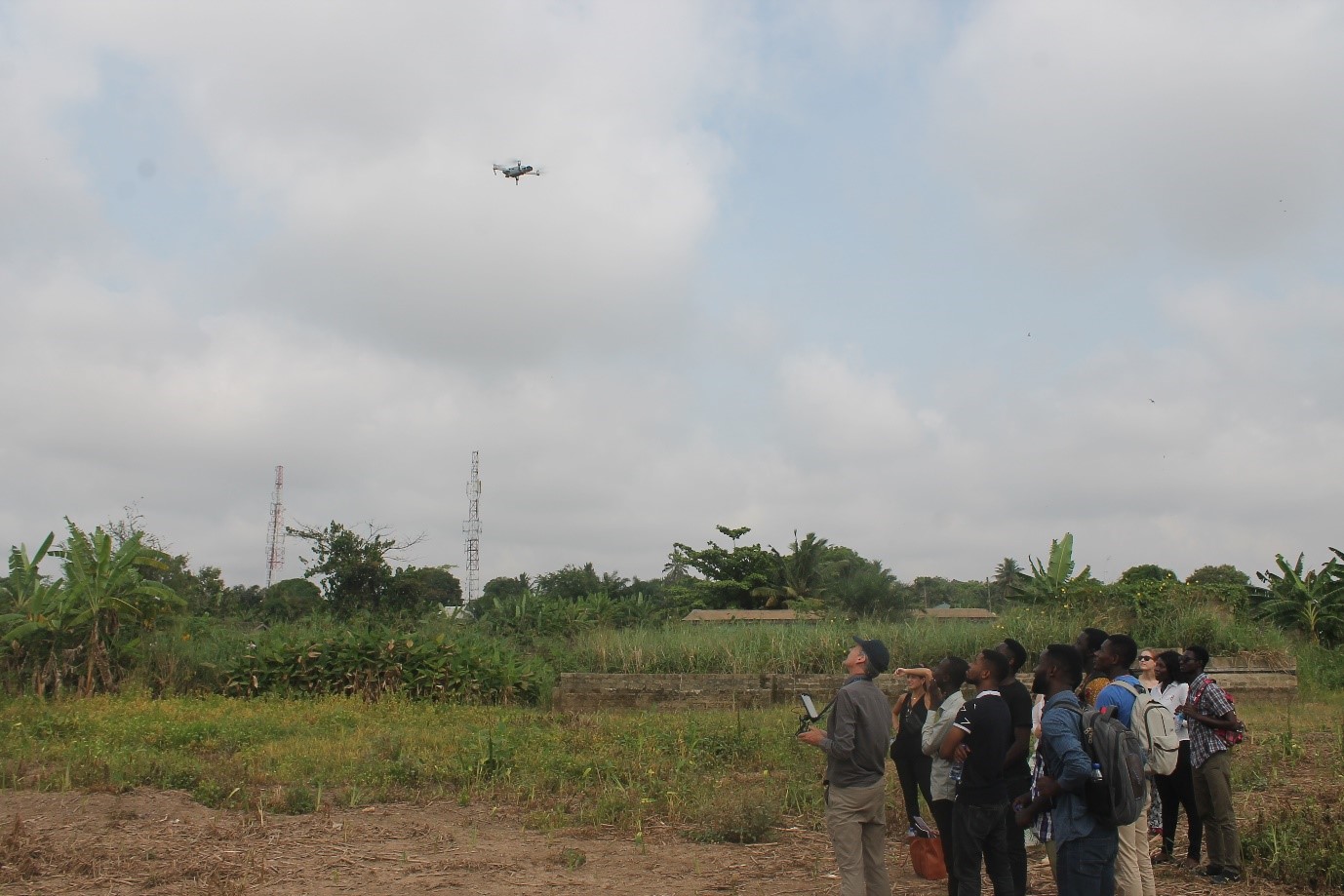
Apart from piloting and processing, we had a couple of long strolls in the area of interest to perform other tasks: doing ground validation by making pictures of the surroundings (often related to the plastic waste sites and flood-prone sites) and by measuring ground control points (needed for DEMs). We visited a farmer who has to deal with flooding every year. So, with all the hikes in the field, even the body condition was taken care of during this training. I’d like to thank all participants and looking towards the next encounter!
Written by Jan van Til (HiView).