Desafío
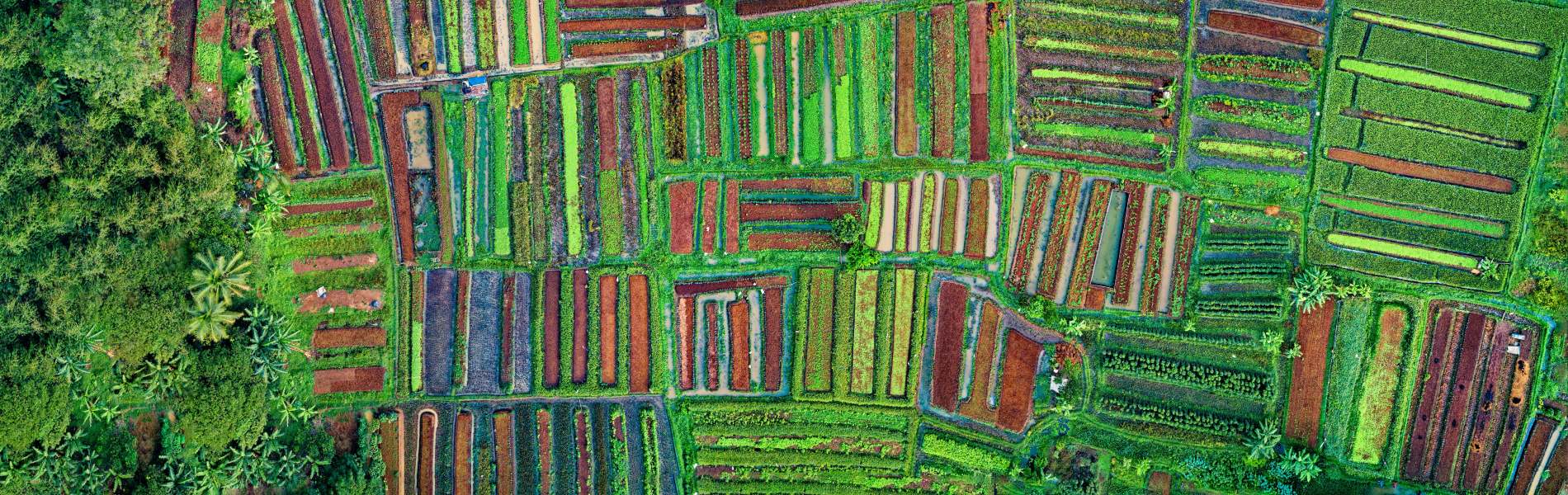
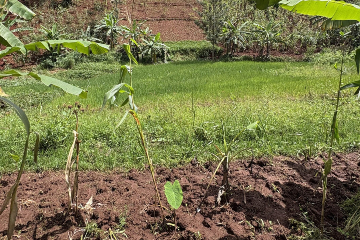
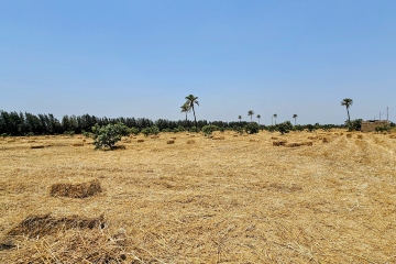
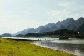
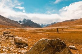
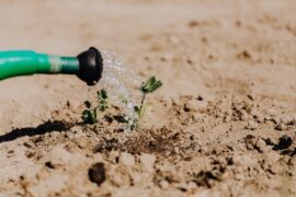
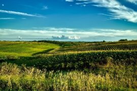
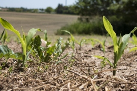
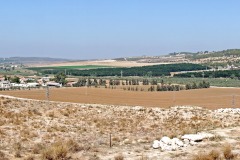
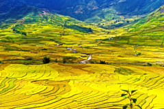
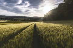
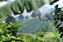
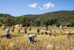
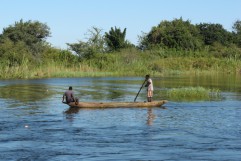
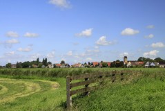
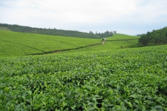
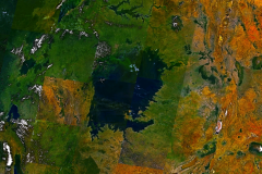
Satisfacer las demandas de alimentos y fibra de una población mundial en crecimiento es un desafío considerable. Hasta la fecha, la agricultura de regadío ha sido responsable del 40% de la producción total de alimentos y fibra a nivel mundial, mientras que utiliza solo el 18% de la tierra cultivable del mundo (Schultz et al., 2009). Sin embargo, los requisitos de riego representan casi el 70% de las extracciones totales de agua dulce del mundo (FAO, 2013) y han alterado significativamente las condiciones hidrológicas y ambientales en los recursos hídricos superficiales y subterráneos (Döll et al., 2009; Kirby et al., 2014 ; Restrepo y Kettner, 2012; Zeng y Cai, 2014). Esto ha generado críticas y debates sobre la insostenibilidad de la agricultura de regadío. Los administradores de riego a menudo deben justificar el uso, la eficiencia y la productividad del agua en competencia y comparación con otros usos y usuarios. El desafío es mejorar las decisiones de asignación de agua para reducir los impactos ambientales negativos, sin dejar de satisfacer las demandas de alimentos y fibra. Hasta la fecha, la investigación y las inversiones se han orientado principalmente hacia la aplicación de tecnologías de alta rentabilidad y de agricultura de precisión, y técnicas ecológicas para lograr el uso sostenible del agua en el desarrollo agrícola (Baumüller, 2018; Chuchra, 2016; Far y Rezaei-Moghaddam, 2018; King, 2017; Nikouei et al., 2012; Pareeth et al., 2019). Dicha tendencia ha sido respaldada por varios objetivos interrelacionados en la Agenda 2030 para el Desarrollo Sostenible, en particular el Objetivo de Desarrollo Sostenible (ODS) 6: Garantizar la disponibilidad y la gestión sostenible del agua; ODS 2: acabar con el hambre, lograr la seguridad alimentaria, mejorar la nutrición y promover la agricultura sostenible y ODS 13: tomar medidas para combatir el cambio climático y sus impactos. El gran desafío es mejorar la agricultura de riego local para lograr los objetivos de los ODS interconectados. Se debe implementar el equilibrio correcto entre aumentar la producción agrícola y reducir los impactos ambientales para mantener de manera segura nuestros recursos hídricos y satisfacer las crecientes demandas de alimentos y fibra.
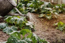
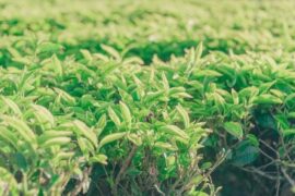
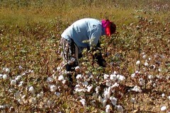
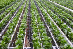
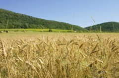
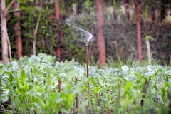
El sector agrícola tiene como objetivo satisfacer la creciente demanda de alimentos al tiempo que reduce el consumo de agua asociado, que es esencial para las regiones que se enfrentan situaciones de escasez severa de agua. Tanto la producción de alimentos como el agua están integradas en el indicador «productividad del agua», también conocido comúnmente como «eficiencia en el uso del agua». Este término proporciona información sobre la cantidad de producción agrícola lograda con el agua consumida a través de la evapotranspiración. La productividad del agua se utiliza como un indicador de rendimiento para diversos fines, entre los que se incluyen (entre otros): cuantificar las mejoras realizadas mediante la implementación de buenas prácticas; identificar ubicaciones de alta productividad del agua; y determinar el potencial de mejora a través del análisis de brecha de rendimiento. El desafío para este campo de rápido crecimiento es 1) desarrollar datos espaciales de alta calidad sobre la productividad del agua y 2) traducir esta información en aplicaciones prácticas para apoyar al sector agrícola en la toma de decisiones.
Enfoque FutureWater
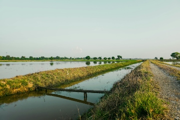
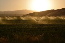
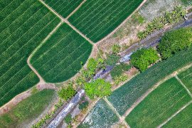
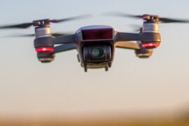
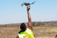
FutureWater tiene como objetivo proporcionar investigación y consultoría para ayudar a mejorar la gestión de los recursos hídricos en todo el mundo a través de la aplicación de nuevas herramientas y tecnología. Particularmente en proyectos de riego, el enfoque consiste en integrar conjuntos de datos hidrometeorológicos de estaciones terrestres y sensores remotos, y simulaciones de modelos hidrológicos y de cultivos para mejorar la evaluación de la disponibilidad de agua y la demanda colocada en áreas irrigadas. También se utilizan conjuntos de datos hidrometeorológicos procedentes de satélites y sensores aéreos no tripulados para apoyar las decisiones de asignación de agua y entregar evaluaciones oportunas de los recursos hídricos en grandes regiones, pero también a nivel de parcela. Como consecuencia de estas evaluaciones, se puede proporcionar asesoramiento sobre la programación del riego, la idoneidad de los cultivos y la planificación del área de riego en función de los escenarios de impacto considerando la variabilidad climática y el cambio climático. Gracias al uso de sistemas y modelos de información geográfica de última generación, es posible obtener información espacialmente distribuida para diferentes niveles de asesoramiento (por ejemplo, nivel de parcela, distrito de riego o nivel de cuenca). A través de estas herramientas, FutureWater proporciona consejos de riego de elevada precisión en muchas áreas del mundo, ayudando a contribuir al logro de los objetivos de los ODS.
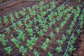
El enfoque adoptado en FutureWater para calcular la productividad del agua es a través de la integración de imágenes de teledetección y modelado de cultivos. Las imágenes de teledetección proporcionan observaciones espaciales de la superficie, obtenidas a través de plataformas satelitales o sensores aéreos no tripulados (UAV). El tipo de imágenes se selecciona según la resolución espacial requerida y la frecuencia temporal de las observaciones (intervalos de tiempo). Posteriormente, las imágenes se combinan con observaciones de campo y modelos de cultivos para hacer un cálculo del rendimiento del cultivo, el balance hídrico y, en última instancia, la productividad del agua. Como complemento de este enfoque, los análisis se realizan utilizando bases de datos de acceso abierto que proporcionan información espacial sobre la productividad del agua, el consumo de agua o la clasificación de la cobertura del suelo. En última instancia, los resultados se presentan para uso práctico, como en mapas de campo o de cuenca que indican la variación espacial, gráficos y otras ilustraciones para monitorear tendencias, o aplicaciones integradas (teléfonos inteligentes / tabletas) para ayudar al trabajo de extensión de los agricultores. La productividad del agua como herramienta de monitoreo y servicio de asesoramiento se puede aplicar a diferentes escalas espaciales y para varias partes interesadas: distribución sobre las áreas agrícolas en una cuenca fluvial, monitoreo de ODS (6.4) a escala nacional, distritos de riego, comerciales y pequeños agricultores.
Proyectos relacionados
-

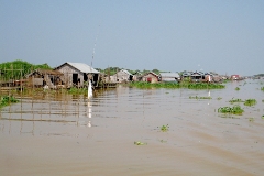
Plan Director de Cuencas Fluviales Resilientes de Camboya – Fase 1: Grupo de la cuenca del río Tonle Sap
El Plan Director de Cuencas Fluviales Resilientes de Camboya promueve un enfoque más integrado, basado en datos empíricos y resiliente al cambio climático para la gestión de los recursos hídricos en Camboya, comenzando por el Grupo de la Cuenca del Río Tonle Sap. El proyecto responde a la creciente presión...
-
Contabilidad hídrica de la cuenca del Indo, el Punjab y la provincia de Sindh en Pakistán
El proyecto tiene como objetivo desarrollar un sistema integral de contabilidad hídrica para la cuenca del Indo y las provincias de Punyab y Sindh, con lo que se reforzará la capacidad de Pakistán para evaluar los recursos hídricos, la demanda y los usos del agua a múltiples escalas y en...
-
DROPS – WISE
DROPS-WISE (Sistema de Observación y Predicción de Sequías y Precipitaciones – Servicio de Inteligencia Hídrica para Europa) es una solución digital avanzada que se está desarrollando para reforzar la adaptación al cambio climático y la resiliencia hídrica en toda Europa. DROPS-WISE integra datos de observación de la Tierra, mediciones in...
-
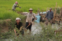
Remote-sensing-based Rice Mapping and Crop Water Productivity Analysis for Two Irrigation Schemes in Timor-Leste
La FAO ha contratado a FutureWater para desarrollar un mapeo de arroz basado en teledetección y un análisis de la productividad del agua en los cultivos, dirigido a los especialistas nacionales en SIG y estadísticas del MALFF. Este análisis responde a las necesidades inmediatas del MALFF para evaluar la superficie...
-
Digital Peace Water (DPW): Acceso equitativo al agua mediante tecnología transparente, Karuzi, Burundi
El DPW es un proyecto de asistencia técnica del Centro y Red de Tecnologías Climáticas (CTCN) en el marco del programa AFCIA, gestionado por el PNUMA. El proyecto lo lleva a cabo un consorcio liderado por Zephyr Consulting, junto con FutureWater, sensors.AFRICA (Code for Africa) y la ONG burundesa APRN/BEPB....
-
Smart Sprayer: riego eficiente en Nepal
El proyecto introduce el paquete Smart Sprayer, una solución integrada que combina: 1) Un sistema de riego micro-pivote de bajo coste, alimentado por gravedad (el Sprayer), diseñado para funcionar con presiones y caudales de agua muy bajos, ideal para terrenos montañosos y explotaciones agrícolas remotas. 2) Una herramienta de riego...
-
Repercusiones del cambio climático en el drenaje del oeste de Georgia
La parte occidental de Georgia, con su clima subtropical húmedo, se enfrenta a importantes retos debido a las frecuentes inundaciones y anegamientos, que afectan a la productividad agrícola y a los medios de vida rurales. La infraestructura de drenaje existente, desarrollada principalmente durante la era soviética, se ha deteriorado debido...
-
Ventanas seguras de siembra para la horticultura en Ghana
¿Cómo saben los agricultores cuándo plantar sus semillas? En Europa, los agricultores se basan en datos meteorológicos de alta calidad para determinar las fechas óptimas de siembra. En África, sin embargo, las estaciones meteorológicas son escasas, lo que da lugar a predicciones de precipitaciones poco precisas. Esto es especialmente problemático...
-
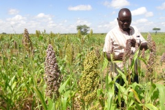
BUCRA: Construyendo Unidad para una Agricultura Resiliente al Clima
El proyecto BUCRA capacita a los pequeños agricultores del delta del Nilo en Egipto con prácticas agrícolas climáticamente inteligentes y herramientas digitales avanzadas. Utilizando Croptimal y SOSIA de FutureWater, el proyecto optimiza la selección de cultivos y la eficiencia del riego, abordando la escasez de agua y el cambio climático....
-
Water Allocation for Biodiversity Conservation in the Lower Amu Darya
The objective is to increase water supply to ecosystems upstream in the Amu Darya delta, upstream of the Aral Sea. The project consists of water allocation analysis and develop water supply scenarios for irrigated agriculture and biodiversity conservation, through consultations and water allocation modelling.
-
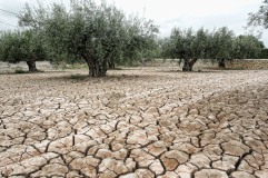
Climate Trends and Projections for Olive Production, Andalucia, Spain
The primary goal of this research is to examine the climatic changes projected for two key regions in Andalucia, Spain, which are deemed crucial for olive production. The study analyzes trends and future projections concerning rainfall, temperature, river flows, and evapotranspiration rates, discussing their potential impacts on both the micro...
-
Evaluación de la resistencia climática y análisis de inversiones en la cuenca del Limpopo
El objetivo principal de este estudio es llevar a cabo una revisión de los escenarios de desarrollo de los recursos hídricos considerados en el Limpopo Scoping Study (2010) y la Limpopo Monograph (2013), para producir escenarios actualizados de desarrollo futuro y evaluarlos en términos de beneficios sociales, económicos y ambientales,...
-
Capacity Building on Water Accounting Under the Water Scarcity Program for Asia-Pacific
Growing water scarcity continues to threaten the agricultural sector in Asia. In order to address this critical issue, FAO and partners have been developing a comprehensive Asia Pacific Water Scarcity Programme (WSP) since 2019. Under this program, a series of trainings on water accounting will be held in Indonesia, Vietnam...
-
SOSIA+: Climate Smart Irrigation Services in Ghana
Earlier this year FutureWater finished a very first draft of the irrigation advisory application SOSIA, with promising results in Rwanda and Zambia. The SOSIA Irrigation Advisory Tool was based on satellite data only. For this project, the SOSIA+ tool will be developed. SOSIA+ will also include real-time local ground data...
-
MAGDA: Meteorological Assimilation from Galileo and Drones for Agriculture
El proyecto MAGDA tiene por objeto proporcionar un sistema integrado, aunque modular, de predicción de condiciones meteorológicas adversas y avisos de riego mejorados mediante diversas tecnologías de observación meteorológica desde satélites, drones y tierra. Las principales aplicaciones consistirán en alertas sobre condiciones meteorológicas adversas que puedan afectar a los cultivos...
-
Strategic Climate Adaptation Planning for the Amu Darya Basin in Uzbekistan
Uzbekistan's water resources depend to a large extent on those provided by the transboundary Amu Darya river which are fully allocated and highly sensitive to climate change and water demand and management changes. Especially the agricultural sector, but also the energy and urban water supply sector need to transform into...
-
Capacity Building on Water Accounting in Pakistan
The Food and Agriculture Organization of the United Nations (FAO) in Pakistan has recently secured Green Climate Fund (GCF) funds for increasing the climate resilience of agriculture and water management in the Indus Basin. Given the region’s climate vulnerability, it is critical to improve information services and build the country’s...
-
SOS-Water: Water Resources System Safe Operating Space in a Changing Climate and Society
El objetivo del proyecto SOS-Water es establecer los límites dentro de los cuales la capacidad del paisaje para proporcionar servicios ecosistémicos no esté en peligro y la capacidad de la sociedad para adaptarse a los cambios ambientales no esté sobrecargada. Cruzar esos umbrales o puntos de inflexión en el complejo...
-
SOSIA: Small-Scale Open Source Satellite-based Irrigation Advice
FutureWater currently furthers the development of the SOSIA tool: an irrigation advice for small-scale food producers. Due to the lack of local weather station data, virtual weather stations derived from open-source satellite data are established, and combined with crop stage, and projected and historical precipitation data. The SOSIA tool allows...
-
BONEX: Boosting Nexus Framework Implementation in the Mediterranean
BONEX es un proyecto financiado por la Fundación PRIMA-UE específicamente para la región mediterránea. Esta región se enfrenta a varios retos para garantizar la seguridad futura de los alimentos y el agua, preservando al mismo tiempo los ecosistemas. BONEX explora y desarrolla soluciones específicas que promueven la vinculación de la...
-
Identificación de hotspots de degradación de tierras y riesgo climático
This projects entails a risk assessment of selected value chains in the context of progressing climate change which is expected to impact on degradation processes in dryland agriculture over the next decades. A global-scale assessment of the potential impact of climate change on land degradation is performed. Per-country estimates of...
-
Follow the Water: Reuse of Water in Irrigated Systems
Reuse of water in irrigated systems is a key component in design and management of irrigation systems. FAO and FutureWater developed a Guidance document, a Tool and a Training package demand for a better understanding of the role of reuse of water in irrigated agriculture systems. Those outcomes will support...
-
Groundwater Recharge in the Campo de Cartagena Quaternary Aquifer
This project (1) provides a critical review of previous results generated, and a SWOT analysis of hydrological simulation tools used in the area. (2) improve and update the quantification of the main water balance components, including vertical and lateral fluxes, at the basin scale in recent times (2000-2020 period) through...
-
Training on Real Water Savings for FAO’s Regional Water Scarcity Program
The Regional Office for Asia and the Pacific (RAP) of the Food and Agriculture Organization of the United Nations (FAO) has recently secured funds to continue a program of training on ReWaS, which is a simple tool to estimate the potential for generating real water savings from various agronomic, water...
-
Tailor-made Training on Climate Smart Irrigation Strategies to Improve Salinity Control and Enhance Agricultural Production
This tailor-made training, funded by Nuffic and requested by the staff of the college of Agriculture of Basra University, aims to help mitigate soil and water salinization problems hampering agricultural production in Iraq. The training focuses on accessing and using innovative data and tools in the public domain, to gain...
-
HiFarm: Data Driven Agricultural Intensification Pilot Program for Maize, Coffee and Tea Farmers in Kenya
The eco.business Fund, in partnership with FutureWater and Export Trading Group (ETG), one of the largest integrated agricultural supply chain managers and processors in sub-Saharan Africa, has launched a pilot project in Kenya for data-driven agricultural intensification. This project aims to improve farmer productivity and profitability whilst enhancing the environmental...
-
A Practical Farmers’ Toolkit – Geodata for Climate Smart Agriculture in Egypt
The 'Farmers Toolkit' as presented in this project contains various geodata tools applicable for farmers to assist their decision-making and adopt climate smart agricultural practices. This project launches a training program on these tools, which are: Flying Sensors, irrigation advisory services (IrriWatch portal), WaPOR and Google Earthengine Apps, and Climate...
-
Tailor-made Advice and Training on Flying Sensors for Agriculture in Jordan
This online training was provided over a period of 8 weeks for 25 participants selected by NARC (National Agricultural Research Centre) Jordan. The online training consisted of self-paced exercises and regular live (video) sessions provided through the OpenCourseWare website of IHE Delft. The four modules provided in this training will...
-
Cadastre Mapping with Flying Sensor Imagery in Mozambique
In this project TerraFirma hired FutureWater, HiView and ThirdEye Limitada (Chimoio, Mozambique) to acquire flying sensor imagery over a pilot area near Quelimane, Mozambique. The objective of this pilot project is to determine the suitability of using flying sensor imagery for cadastre mapping in an area of small-scale agriculture in...
-
WAT4CAM: Mekong-Bassac Hydrological and Hydraulic Study
The WAT4CAM program aims to apply IWRM and ISWM principles towards achieving the strategies of the government of Cambodia. This project (WAT4CAM subcompoment 3.1) supports this objective by performing a detailed hydraulic and hydrological modelling study, of which the outcomes will be used in the implementation of Prek rehabilitation works....
-
Future Evapotranspiration in the Souss-Massa Basin
In this project, FutureWater used the outputs of the bias corrected "EuroCordex" RCM ensemble generated for IMWI in a previous work package. Using temperature and precipitation trends from this dataset for both past and future, an application of the Budyko methodology combined with the Modified Hargreaves approach was implemented to...
-
CAREC: Developing the Water Pillar for Central Asia
For the Central Asia Regional Economic Cooperation (CAREC) Program, a scoping study was commissioned to develop a framework for the Water Pillar: an investment vehicle for water infrastructure and capacity development that generate regional benefits. The objective of the study is to develop the scope of the Water Pillar Framework...
-
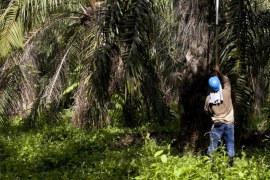
Riego eficiente de palma aceitera en Colombia
Este proyecto es un estudio de factibilidad sobre la adopción de técnicas de riego más eficientes por parte de los productores de palma aceitera en la cuenca del río Sevilla, una de las cuencas más relevantes en la Sierra Nevada, Colombia. El objetivo general es identificar el entorno local a...
-
Tailor-Made Training on Crop Models and Remote Sensing for Water Management in Agricultural Systems
FutureWater, HiView and ThirdEye Kenya have partnered with Egerton University (Crops, Horticulture & Soils Department) to conduct a tailor-made training on 'Crop models and remote sensing for water management in agricultural systems'. This training project is funded by the NUFFIC - TMT program.
-
Climate Risk Assessment of Irrigation and Drainage Modernization Projects
The ADB supports Tajikistan in modernizing tow Irrigation and Drainage projects in the Lower Vaksh river basin in Tajikistan. A holistic feasibility study and project design for the system (38,000 ha), as well as advanced designs and bidding documents for selected works are prepared. FutureWater prepares the Climate Risk and...
-
Transboundary water management between Thailand and Cambodia
Transboundary projects aid the development of effective water resource management (WRM) by helping to limit competition over resources and in creating a dialogue for the transferral of beneficial lessons between the countries. This project takes an integrated approach to support the development of a water resource management plan for a...
-
Detection of On-farm Reservoirs in Irrigated Areas
The detection of on-site farm reservoirs and ponds in large areas is a complex task that can be addressed through the combination of visual inspection of orthophotos and the application of automatic pixel classification algorithms. This analysis performs a general workflow based on the usage of a Random Forest classifier...
-
Climate Adaptive Water Resources Management in Uzbekistan
The project undertakes a long-term and knowledge-based approach to deliver climate adaptive solutions for water resources management in Uzbekistan. The purpose is to modernize outdated irrigation and drainage systems that are currently highly vulnerable to climate change and to changes in inter-state agreements on water resources sharing. For two areas,...
-
Incorporating Flying Sensors to Increase Agricultural Productivity in Central Mozambique
The PROMAC II project is an ongoing project of NCBA Clusa introducing conservation farming practices to various locations in the Manica, Tete and Zambezia provinces, with the objective to increase agricultural productivity. This project incorporates flying sensor activities in the PROMAC II project as a M&E indicator of the practices...
-
Mavo Diami: Services on Land-crop Suitability Mapping and Operational Irrigation Advice in Angola
The overall project goal is to improve sustainable food and income security for >100,000 smallholder farmers in Angola, by accelerating their agri-business performance through informed decisions supported by the Mavo Diami services built on weather, soil and crop signals and other relevant data and indicators. Ensuring the services are offered...
-
Training Package and Technical Guidance for Water Productivity and Real Water Savings
The overall project objective is to compile an inventory of agricultural field interventions and develop a training package to evaluate Real Water Savings from irrigated fields, to systems and basins. A guidance document is developed for agricultural field interventions by compiling a literature database containing published experiences and results of...
-
Evaluación de recursos hídricos y servicios ambientales en las cuencas Tonle Sap y del Delta del Mekong
El objetivo general del proyecto es apoyar al Ministerio de Recursos Hídricos y Meteorología de Camboya (MOWRAM) para la toma de decisiones informadas y basadas en evidencias que mejoren la gestión de los recursos hídricos y de nuevas inversiones en proyectos de riego en dos cuencas del país: Tonle Sap...
-
Seguimiento operacional del estado de las praderas del Valle del Alagón mediante índices de satélite
Este proyecto se enmarca dentro de las actividades asistencia técnica que FutureWater provee al Grupo Operativo ECOPRADERAS. FutureWater tiene la encomienda de desarrollar una herramienta operacional para la evaluación del estado vegetativo de las praderas de la Vega del Alagón (Extremadura) mediante el seguimiento de indicadores satelitales y el análisis...
-
APSAN-Vale: Piloting Innovations to Increase Water Productivity and Food Security in Mozambique
The project has as its overall aim to increase climate resilient agricultural productivity and food security, with a specific objective to increase the water productivity and profitability of smallholder farmers in Mozambique, prioritizing small (family sector) farmers to increase food and nutritional security. This project will demonstrate what the best...
-
Evaluación del riesgo climático usando el Marco del Árbol de Decisión para dos proyectos hídricos en Kenia y Nepal
La novedosa metodología del Marco del Árbol de Decisión (DTF) del Banco Mundial se emplea para evaluar los riesgos climáticos versus otros riesgos no climáticos asociados a dos inversiones planificadas: (1) la infraestructura de protección contra inundaciones y expansión de tierras de cultivo irrigadas en el río Nzoia (Kenia); y...
-
AgriSeasonal: Seasonal Climate Services for Agriculture
Future climatic and hydrologic conditions have significant impacts for selecting crops varieties, planning the growing season and ensuring water supply during the irrigation period. To the present day, monthly to yearly decisions in agriculture rely on past climate observations. This practice is going to fail more frequently in the context...
-
Agricultural Water Consumption in the Australian Border Rivers Catchment
FutureWater was hired to use satellite-derived data to provide a preliminary spatiotemporal assessment of water consumption across the Border Rivers catchment, one of the MDB catchments where excessive agricultural water use is an urgent issue. For relevant specific lots / properties, monthly water consumption dynamics were evaluated. This study is...
-
Remote Sensing Course in Angola
The project "Knowledge-to-Knowledge" (K2K), aims to strengthen and enhance the capacity of the main Angolan knowledge institutions in agricultural sciences, to establish a strong relate between knowledge and practice. FutureWater collaborates with Wageningen University on giving a training on remote sensing and GIS techniques in agricultural applications and services to...
-
TWIGA: Transforming Weather Water data into value-added Information services for sustainable Growth in Africa
TWIGA aims to provide actionable geo-information on weather, water, and climate in Africa through innovative combinations of new in situ sensors and satellite-based geo-data. With the foreseen new services, TWIGA expects to reach twelve million people within the four years of the project, based on sustainable business models. The TWIGA...
-
Remote Sensing for Land Suitability Assessment in Angola
The government of Angola considers the agricultural sector as an economic sector that offers great prospects and therefore aims to further develop the agricultural sector in order to diversify its economy. The potential for expanding the area under production is great. To support the effective planning of interventions that increase...
-

Water Productivity mapping using Flying Sensors and Crop Modeling
The objective of this pilot study was to achieve plot-level maps of water productivity and yield to test a methodology to assess the performance of different farmers in order to provide them with recommendations to improve water productivity. More specifically, this pilot study combined high-resolution imagery from Flying Sensors with...
-
Climate Risk and Vulnerability Assessment of Irrigation in Kazakhstan
The government of Kazakhstan with financial support of the Asian Development Bank (ADB) is planning to upgrade and rehabilitate its irrigation sector. A detailed Climate Risk and Vulnerability Assessment (CRVA) has been undertaken by a consortium led by FutureWater in 2017. The team collected all available data on the project...
-
DAISY2: Daring Applications and Innovations in Sensor sYstems
DAISY2 builds on the success of the DAISY project in which a compact and mobile sensor system was developed aimed at different socio-economic applications like e.g. security, life-sciences, transport, logistics, and agro-food. Within DAISY2 we aim to further develop this sensor system and explore the viability of this products for...
-
BRIGAID: BRIdging the GAp for Innovations in Disaster resilience
Los estudios publicados recientemente por el Panel Intergubernamental del Cambio Climático (IPCC) indican que Europa estará sometida a un mayor número de eventos hidroclimáticos extremos (inundaciones, sequías, olas de calor e incendios forestales). Sin embargo, estos estudios también identifican un gran potencial para que la comunidad científica, inversores y las empresas innoven, impulsen e implementen...
-
IMPREX: Mejora en la predicción y gestión de los eventos hidrológicos extremos
IMPREX parte de la base de que mejorar la comprensión de los riesgos actuales es un punto de partida eficaz para adaptarse a los cambios futuros. Teniendo en consideración las posibles trayectorias climáticas y la experiencia obtenida a lo largo de un conjunto de sectores fuertemente dependientes del agua, IMPREX evaluará la efectividad de las...
-
Water Resources Model for the Kenate Basin in South-Sudan
As there is an urgent need for informed decision making in ongoing and upcoming land and water resource development plans, the governments of South Sudan and the Netherlands (GoN) initiated a program for the Water Sector in Eastern Equatoria State (ProWasEES). The overall objective of this program is that “Kenate...
-
CITRUSFLUX: Balance de agua y carbono en agrosistemas regados de cítricos
Aproximadamente 22 millones de toneladas de cítricos, un 20% de la producción total mundial, se producen en la región circun-mediterránea. Historicamente, los cultivos de cítricos se han concentrado a lo largo de valles fluviales y ramblas donde se localizan los suelos más fértiles y existe una mayor accesibilidad al agua superficial o del subálveo. La...
-
Inclusive Development Paths for Healthy Red River Landscapes
Rapid land use changes in the Red River Basin threaten water resources. This project will be working in the Day River Catchment, a Red River distributary important for Hanoi, where most of these problems are manifest. The project will develop equitable and economically viable pathways for the land and water...
-
Fresh Water Options Optimization
This project identified opportunities for innovative solutions that decrease local fresh water shortages in economic vulnerable regions under increasing water stress (droughts, salinization). The project demonstrated the business potential of fresh water solutions for a case study area with intensive agriculture within the Valencia region, Spain. FutureWater’s role in this...
-
ThirdEye: Flying Sensors to Support Farmers’ Decision Making
The ThirdEye project supports farmers in Mozambique and Kenya with their decision making in farm and crop management by setting up a network of flying sensors operators. Our innovation is a major transformation in farmers’ decision making regarding the application of limited resources such as water, seeds, fertilizer and labor....
-
Online field-scale irrigation management for Romania
In this project a field-scale irrigation planning and management system was setup and tested. The basis for this system is formed by online in-situ ground data on soil moisture content and hydrological model calculations of the root zone and shallow subsoil. Weather stations and soil moisture sensors were installed at...
-
Water Planning Tools to Support Water Governance
ARA-Centro is one of the five regional water management organizations in Mozambique and has to advise on the water availability and the required number of reservoirs that are needed to make the envisioned economic developments possible. For this advisory role, tools are needed like a water allocation model that can...
-
Review of the First Hydroponic Greenhouses Project at Barka, Oman
Oman is one of the world’s most arid countries where water availability fully relies on groundwater resources and desalinization plants. The average annual rainfall depth has been estimated is around 60 mm, varying from less than 20 mm in the internal desert regions to over 300 mm in the mountain areas. This rainfall on mountain...
-
Green Water Credits demonstration project Algeria
In cooperation with Algerian partners the “La Mina” basin was selected to demonstrate the potential for Green Water Credits (GWC) in Algeria. GWC can be seen as an investment mechanism for upstream farmers to practice soil and water management activities that generate benefits for downstream water users, which are currently...
-
High-resolution versus coarse-resolution remote sensing images in crop yield forecasting
The objective of this project was to evaluate the added value of high-resolution above coarse-resolution remote sensing images in crop yield forecasting. This is especially relevant if the focus is on small-scale farming where the distribution of crop types is often extremely heterogeneous. For this study the Soil-Water-Atmosphere-Plant (SWAP) model...
-
DAISY: Daring Applications & Innovations in sensor SYstems
This project aimed at the development of a new sensor system, to be built by the end of 2014. This development process was run parallel to the exploration of new applications in the field of agribusiness, food business, and the environment that become possible through the new sensor system. The...
-
Mainstream Climate Change Adaptation and Mitigation Into Agriculture in the Southern Caucasus
This study contributes to the agriculture sector climate change impact assessment and adaptation and mitigation strategy identification and evaluation. The study encompasses the three countries of the Southern Caucasus region: Armenia, Azerbaijan, and Georgia. The project also includes components for capacity building among in-country staff, and support of the World...
-
Assessing the effects of farm-level irrigation modernization on water availability and crop yields
Egypt is modernizing its irrigation systems and management practices from supply-based to demand-based irrigation water supply. The expected result is that farmers will take in less irrigation water, as they are assured that water is continuously available. During this project, the consequence of changing from supply-based irrigation to demand-based irrigation...
-
SIRRIMED: potenciar el uso sostenible del agua mediante la mejora de las técnicas de riego y el desarrollo de herramientas de gestión
El proyecto “Sustainable use of irrigation water in the Mediterranean Region” (SIRRIMED) es un proyecto europeo de cooperación del VII Programa Marco, enmarcado en la temática “Alimentación, Agricultura, Pesca y Biotecnologías”, que cuenta con un presupuesto superior a 4 millones de euros, y en el que participan quince socios de ocho países distintos: España, Italia,...
-
Evaluación del potencial de regadío de los países del Nilo en África Central
In order to fill gaps in the Nile Basin Initiative and member country information bases on agricultural water use the irrigation potential of seven Nile countries was assessed. This project consisted of several consecutive steps, in which hydrological modelling, the use of remote sensed data, ArcGIS analyses, consultation workshops and...
-
REDSIM: Farm information and advisory systems for deficit irrigation management
En muchas áreas del sur de España y otras zonas mediterráneos, sigue existiendo un gran potencial de mejorar la productividad de las tierras de regadío. El aumento de la productividad del agua en la agricultura es la clave para mitigar los impactos de la escasez hídrica debido a eventos naturales (sequía) o por el aumento...
-
Impacts of Global Climate Change on the Water Resources of the Bunyala plains, Kenya
In this project an Integrated Water Resource Management Planning Tool for improved planning and management of sustainable food and sustainable livelihoods for the Bunyala flood plains of western Kenya was developed together with training materials for technical support in the maintenance and implementation of the planning tool and the facilitation...
-
Scenario Based Water Resources Model to Support Policy Making
Appropriate planning in water resources, and more specifically in irrigation, is becoming increasingly important. However, policy makers and planners are often constrained by insufficient knowledge and tools to evaluate the consequences of alternative interventions. To illuminate these issues, a scenario-based policy oriented demonstration model was developed. The model focuses on...
-
Irrigation Potential Lake Victoria, Tanzania
A study was undertaken to evaluate and rank five potential irrigation schemes in the Tanzania part of the Lake Victoria Basin. The study focused on the following five thematic areas: (i) land suitability, (ii) water resources assessment, (iii) water requirements, (iv) environmental considerations, and (v) institutional aspects.
-
Remote Sensing and Hydrological Modelling of the Rio Bravo, Aguascalientes and Central Northern Valleys
The project has shown how modern analytical tools such Remote Sensing, GIS and simulation models can help to swiftly obtain data to support the water management decision making process. A diagnosis of the Rio Bravo and Northern Central Aquifers has been made to demonstrate management options as well as how...
-

Adaptation to Climate Change for Agriculture in The Gambia
Methodology Development of adaptation benefit-cost framework: The framework was developed in a manner to make it possible to isolate development- and climate-related benefits and costs of individual projects and to assess the sensitivity of adaptation benefits and costs to the uncertainty inherent in regional climate change scenarios. Development of analytical tools and procedures: The project...