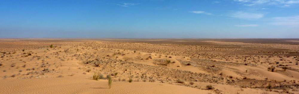
In cooperation with Algerian partners the “La Mina” basin was selected to demonstrate the potential for Green Water Credits (GWC) in Algeria. GWC can be seen as an investment mechanism for upstream farmers to practice soil and water management activities that generate benefits for downstream water users, which are currently unrecognized and unrewarded. The effect of different GWC measures and the potential target areas for GWC pilot operation were identified by a biophysical analysis that was carried out with the SWAT model. This allows decision makers and downstream water users to invest in effective measures to improve water management and increase downstream water availability in a cost-effective way.
Green Water Credits can be seen as an investment mechanism for upstream farmers to practice soil and water management activities that generate benefits for downstream water users, which are currently unrecognized and unrewarded. This initiative is driven by economic, environmental and social benefits. The implementation of GWC has the potential of enhancing overall water management by reducing damaging runoff, increase groundwater recharge, stimulate a more reliable flow regime, and reduce harmful sedimentation of reservoirs.
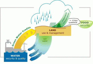
FutureWater coordinated and carried out the biophysical assessment that quantifies the impact of Green Water Credits practices on the green and blue water and sediment fluxes in the Upper Tana basin in Kenya, The Duhe basin in China and the Sebou basin in Morocco. The analysis leads to identification of potential target areas for GWC pilot operation on biophysical grounds. This required a distributed modeling approach (SWAT) accounting for the heterogeneities in the basin in terms of precipitation regime, topography, soil characteristics and land use. The developed tool quantifies the benefits of the management practices on erosion reduction and green and blue water flows in the basin.
In cooperation with Algerian partners the “La Mina” demonstration basin has been selected. With the SWAT model a biophysical analysis will be carried out, based on local available data and wherever needed in combination with remote sensing data. Several measures will be calculated which will quantify the effect of the measure on a selected set of indicators, such as erosion, green water, runoff, evapotranspiration etc. This will allow decision makers and downstream water users to invest in effective measures to improve water management and increase downstream water availability in a cost effective way.
