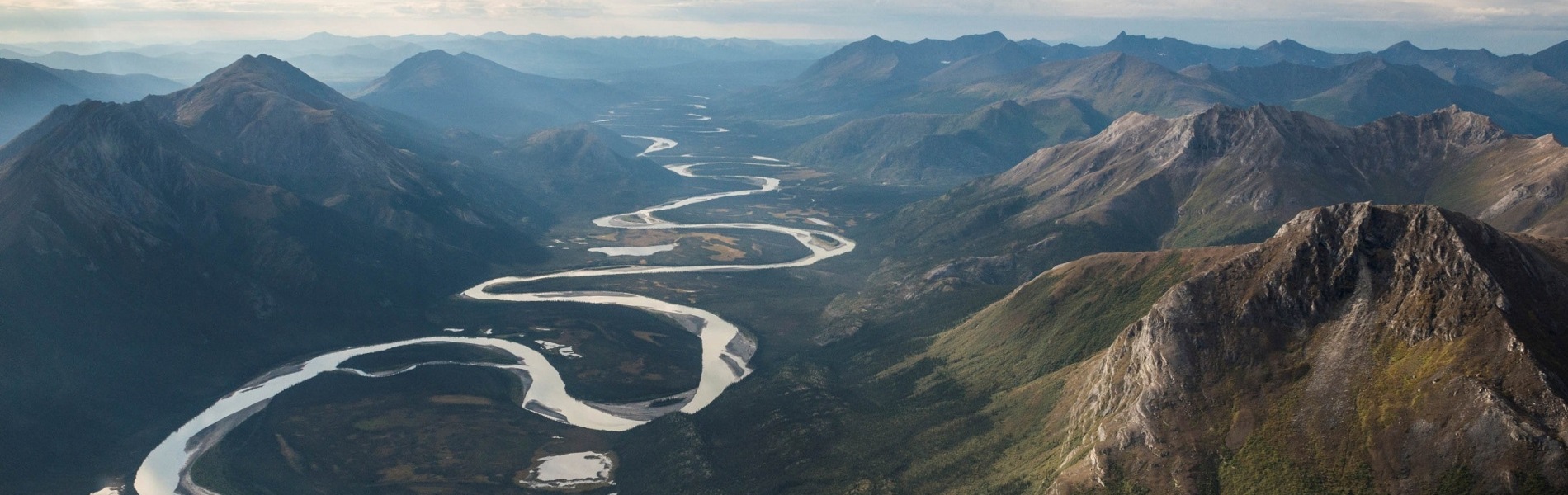
Concepto
SPHY (Spatial Processes in Hydrology) es un modelo conceptual de equilibrio de agua tipo «”cubeta con fugas” espacialmente distribuido (en formato raster). El modelo integra procesos hidrológicos dominantes como (i) lluvia-escorrentía; (ii) salida del lago / embalse, (iii) procesos criosféricos (nieve, hielo, glaciares) (iv) evapotranspiración y (v) procesos hidrológicos del suelo. El modelo SPHY se ha desarrollado y actualizado constantemente combinando los mejores componentes de modelos de simulación existentes y bien probados: SRM, VIC, HydroS, SWAT, PCR-GLOBWB, SWAP y HimSim. SPHY incluye procesos hidrológicos terrestres relevantes a escalas flexibles (local, regional y global), bajo diversos cambios en el uso del suelo, escenarios climáticos y climáticos extremos. Una visión general de los conceptos del modelo SPHY se muestra en la Figura 1.
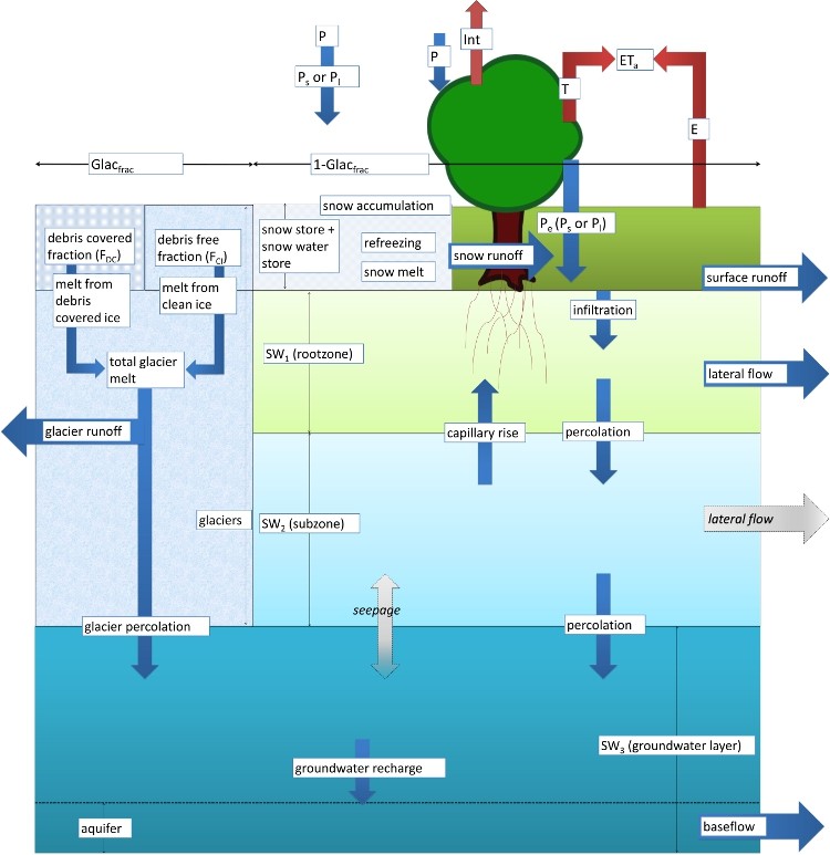
La conservación de masa es el concepto subyacente principal utilizado en el modelo SPHY. Los procesos hidrológicos dominantes están definidos por los conjuntos físicos de ecuaciones y parámetros. SPHY utiliza un enfoque de variabilidad de subcuadrícula para la representación adecuada de los procesos que actúan a escalas espaciales más finas. Una celda puede estar libre de glaciares, parcialmente con glaciares o completamente cubierta por glaciares. La celda sin glaciares puede ser de diferente tipo de uso del suelo. La variabilidad de la subcuadrícula está determinada principalmente por la cobertura de vegetación fraccional, que afecta procesos como la intercepción, la precipitación efectiva y la evapotranspiración potencial.
La columna suelo / tierra se divide en dos almacenamientos superiores de suelo y un tercer almacenamiento de agua subterránea, con sus componentes de drenaje correspondientes: escorrentía superficial, flujo lateral y flujo base. La fusión del hielo de los glaciares contribuye a la descarga del río por medio de un componente lento y rápido, siendo (i) la filtración al depósito de agua subterránea que eventualmente se convierte en flujo base, y (ii) la escorrentía directa.
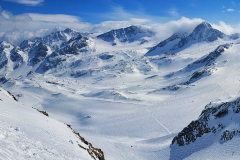
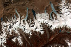
El modelo simula el comportamiento dinámico de los glaciares mediante la incorporación de procesos clave como la acumulación, la ablación y la transferencia de masa de hielo de la zona de acumulación a la ablación. Si el glaciar está perdiendo masa, el hielo de la zona de ablación se redistribuirá sobre la zona de ablación de acuerdo con el volumen de redistribución de hielo.
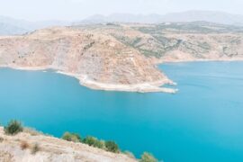
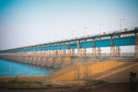
Además, SPHY incluye un módulo de lago que realiza un seguimiento de la altura del nivel del lago y el almacenamiento en cada paso de tiempo de la simulación del modelo. El módulo del lago utiliza un esquema avanzado para enrutar el flujo desde las celdas del lago hacia las regiones aguas abajo. Además, SPHY utiliza un módulo de erosión que calcula la erosión del suelo debido al impacto de las gotas de lluvia, el flujo terrestre y el flujo del río.
No hay un mejor modelo disponible que sea adecuado para todo tipo de aplicaciones. La elección del modelo depende del objetivo general del proyecto. Sin embargo, SPHY se destaca en comparación con otros modelos debido a su amplia gama de funcionalidades como:
Escala espacial
El modelo SPHY se puede aplicar a rangos flexibles de escalas espaciales como granjas de pequeña escala, subcuencas y cuencas de mediana escala y aplicaciones regionales y globales a gran escala. SPHY ayuda al usuario a comprender mejor las diferencias espaciales y la variabilidad del proceso hidrológico clave. Además, el modelo se puede ejecutar en diferentes escalas espaciales para diferentes procesos dentro de la misma simulación. Por ejemplo, el glaciar se puede ejecutar con una resolución de 50 metros, mientras que la resolución del modelo es de 1000 metros.
Escala temporal
El modelo SPHY se puede aplicar de pasos sub-diarios a diarios, semanales, mensuales y anuales dependiendo de las variaciones diarias de los procesos hidrológicos clave y la disponibilidad de datos.
Adaptabilidad
El modelo SPHY se puede adaptar fácilmente para su uso en diferentes condiciones climáticas en todo el mundo. Esto es muy útil si el usuario está estudiando procesos hidrológicos en regiones donde no todos los procesos hidrológicos son relevantes. Un usuario puede, por ejemplo, estar interesado en estudiar los requisitos de agua de riego en África central. Para esta región, los procesos de fusión de glaciares y nieve son irrelevantes y, por lo tanto, se pueden desconectar. Otro usuario solo puede estar interesado en simular las condiciones de humedad en la primera capa de suelo, lo que permite la posibilidad de desconectar los módulos de enrutamiento y de agua subterránea.
Requisito de datos
Un usuario puede usar cualquiera de las observaciones terrestres, como datos hidrológicos: descargas, datos criosféricos: cobertura de nieve, balance de masa de glaciares, datos de cultivos: coeficientes de cultivos estáticos, índice de área foliar, información de lagos y embalses, etc., si están disponibles para una mejor representación y mejorar la precisión del modelo. El modelo se puede suministrar con datos en un enfoque parsimonioso y hambriento de datos, dependiendo de la disponibilidad de datos en la región.
La facilidad de uso
El modelo SPHY es fácil de usar y puede ser aplicado por cualquier persona que tenga un conocimiento general sobre los procesos hidrológicos clave. Se puede proporcionar una serie temporal constante o estocástica estática o mapas ráster más complejos como entradas al modelo según lo especificado por el usuario. Además, el modelo SPHY proporciona una gran cantidad de datos de salida que se pueden seleccionar en función de las preferencias del usuario. La salida espacial se puede presentar como mapas espaciales de todos los procesos hidrológicos. Estos mapas se pueden generar a diario, pero también los agregados en períodos mensuales o anuales. Se pueden generar series de tiempo para cada ubicación en el área de estudio según lo especificado por el usuario.
Aplicaciones FutureWater
FutureWater emplea el modelo SPHY en varios contextos y aplicaciones. El modelo de elección depende de cada proyecto y análisis requerido. Las siguientes son las áreas clave de la aplicación del modelo SPHY.
Cambios hidrológicos pasados y futuros
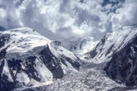
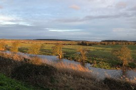
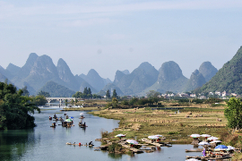
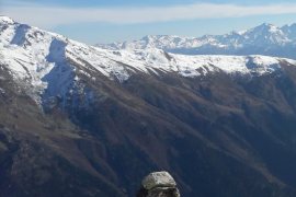
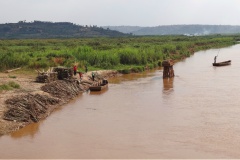
SPHY se ha aplicado en numerosos proyectos para evaluar los regímenes hidrológicos históricos y los cambios futuros en el mismo. El modelo se ha utilizado en proyectos HICAP y HI-AWARE para comprender los aspectos clave de los cambios históricos y futuros en los regímenes hidrológicos de las principales cuencas hidrográficas en el sudeste de Asia y Asia central. Además, el proyecto HI-AWARE explora los cambios en los extremos hidro-climáticos (inundaciones y sequías) en la región. Además, en PanTPE , SPHY se utiliza para explorar los cambios climáticos para el desarrollo ecológico del Cinturón Económico de la Ruta de la Seda (SREB) en la región del tercer polo.
Manejo de cuenca
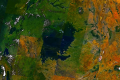
SPHY se ha utilizado en este ‘Cuenca Planificación Estratégica cuenca del río Ganges’ proyecto para entender las interacciones tierra-agua subterránea en la cuenca para refinar el modelado río. El proyecto utiliza una información de flujo ambiental de múltiples escalas a través de la cuenca y utiliza estas evaluaciones para proporcionar retroalimentación al modelado de escenarios. El proyecto también explora una serie de escenarios plausibles que exploran opciones alternativas para mejorar la gestión del agua, incluida la mejora de la salud del río utilizando SPHY.
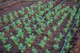
Manejo de riego
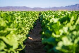
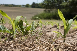
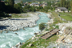
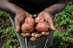
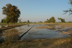
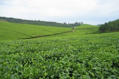
SPHY se ha aplicado para el asesoramiento de riego a pequeña escala, a nivel de finca agrícola en países como el oeste de Rumania y Angola . El sistema consiste en datos in situ sobre el contenido de humedad en el suelo y cálculos con SPHY en la zona radicular y el subsuelo superficial.
Previsión de flujo
SPHY se ha aplicado para el propósito de pronóstico de flujo operativo en una cuenca en Chile. En este proyecto , SPHY se ha utilizado en un sistema integrado, que utilizaba mediciones derivadas de satélites de observación de la Tierra y sensores in situ, para pronosticar el flujo estacional de la corriente durante la temporada de deshielo.
Degradación y restauración de la tierra
SPHY se ha utilizado en Madagascar para la toma de decisiones integrada para la gestión del paisaje en Madagascar a través de datos espaciales mejorados sobre la degradación de la tierra, y mediante el desarrollo de plataformas prototipo para simular, evaluar y reorientar, según corresponda, los procesos de cambio y uso de la tierra.
Energía
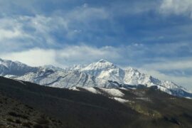
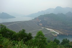
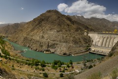
SPHY se ha utilizado en varios países de Georgia , Indonesia , Kenia , Tanzania , Nepal para evaluar los cambios en los flujos futuros de la corriente para el desarrollo de la energía hidroeléctrica. Estos proyectos exploran el uso del suelo y el impacto del cambio climático en los flujos de las corrientes para que los desarrolladores de energía hidroeléctrica los utilicen más a fondo para evaluar la viabilidad técnica y financiera de los proyectos en un clima cambiante.
Extremos hidroclimáticos y eventos compuestos
El modelo SPHY se ha utilizado en varios proyectos de investigación científica como SYSTEM-RISK e IMPREX para explorar un enfoque de sistemas para la evaluación y gestión del riesgo de inundación a gran escala debido a eventos extremos compuestos.
Para obtener más información sobre el proyecto y otras aplicaciones, visite http://www.sphy.nl/.
Proyectos relacionados
-
SPHY GUI Plugins Update
SPHY (Spatial Processes in Hydrology) is a conceptual, spatially distributed (raster-based) “leaky-bucket” type water balance model. Developed by FutureWater, with the support of national and international partners, SPHY has emerged as a robust, user-friendly tool for undertaking operational and strategic water resource management decisions. It stands out for its physical...
-
Model Development and Hydrological Assessments to Inform Ecosystem-based Adaptation Solutions in Lao PDR
The GCF project “Building resilience of urban populations with ecosystem-based solutions in Lao PDR” aims to test an alternative approach to flood control in urban Laos, moving away from a traditional focus on grey infrastructure, such as dams and concrete drainage systems, and towards Ecosystem-based Adaptation (EbA). A consortium led...
-
Megasequías en Las Cuencas De Alta Montaña De Europa
Las megasequías son fenómenos raros y poco conocidos. Se definen como periodos de sequía excepcionalmente severos, carácter multianual y duración prolongada (>5 años), y que generan impactos extremos que afectan a grandes extensiones y diferentes sectores de la economía y del medio ambiente (Cook et al. (2022), Nat Rev Earth...
-

Catchment Assessment for Water Stewardship Plan
Highly productive berry farms and water scarcity are causing conflicts with the environmental assets and values of the Doñana National Park, Spain. There is growing interest in the agricultural sector to reverse this situation by implementing a water stewardship program. A catchment assessment is needed to produce baseline information to...
-
Scientific Support for a Watershed Investment Program for Addis Ababa
Addis Ababa's water supply is under threat caused by the complex interaction of rapid population growth, increased water demand, intensive groundwater development, natural resource degradation, and climate change. A comprehensive Watershed Investment Program should return this situation and secure water supply for the future. An in-depth study is performed to...
-
Pre-Feasibility Work to Identify Nature-based Solutions for Multiple Catchments in Nigeria
This project will involve working across two fee-for-service engagements with the Coca Cola Corporation and Diageo in Nigeria. The identification and prioritisation of NbS for implementation will be achieved through the development of three key products: two prefeasibility analyses for Ogun and Oshun catchments, and a high-level country-wide strategic assessment...
-
Roadside Spring Protection to Improve Water Security in Nepal
The mid and high-altitude areas of the Himalayas face a critical water scarcity issue, making them one of the most vulnerable regions in the world. Springs are essential lifelines for millions of mountain communities, serving as the primary source of domestic water and local food security. Unfortunately, the flow regimes...
-
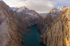
Integrated Water Resources Management in Tajikistan
Given the abundant freshwater resources in Tajikistan, water plays a crucial role in the country's socioeconomic development. However, the rising population, economic growth, and the growing impacts of climate change pose significant challenges to ensure water availability and accessibility. This project aims to address the aforementioned information gap by improving...
-
GLOW: Global Water Availability Forecasting Service to Support Water Security
The GLOW project aims to pilot an operational service that provides timely and easy access to current and forecasted water availability and demand across the entire Maputo River and the Black Umbeluzi River Basins.
-
WE-ACT: Water Efficient Allocation in a Central Asian Transboundary River Basin
The WE-ACT project’s overall goal is to demonstrate a Decision Support System (DSS) for water allocation in a Central Asian transboundary river to increase shared benefits and foster the adaptation of water resources management and planning to climate change.
-
MAGDA: Meteorological Assimilation from Galileo and Drones for Agriculture
The MAGDA project aims at providing an integrated – but modular – system to provide severe weather forecasts and irrigation advisories enhanced by means of various satellite-borne, drone-borne and ground-based weather-observing technologies. The main applications will be in providing both warnings about severe weather that could affect crops and irrigation...
-
Strategic Climate Adaptation Planning for the Amu Darya Basin in Uzbekistan
Uzbekistan's water resources depend to a large extent on those provided by the transboundary Amu Darya river which are fully allocated and highly sensitive to climate change and water demand and management changes. Especially the agricultural sector, but also the energy and urban water supply sector need to transform into...
-
Hydrological Assessment for the Lunyangwa Dam
The Lunyangwa Dam is prone to overtopping during the wet season. Raising the spillway crest and/or installing gates on the existing crest will allow an increase in the retention level. In order to determine the height of the redesigned spillway, a flood analysis was conducted for several return periods in...
-
Gestión y Planificación Integrada de Recursos Hídricos en Ruanda
Ruanda publicó recientemente "Visión 2050”, la estrategia nacional de desarrollo a largo plazo y los nuevos objetivos sectoriales en materia de urbanización, producción de energía, riego y desarrollo de los recursos hídricos. El Fondo Verde de Ruanda (FONERWA) en colaboración con la Junta de Recursos Hídricos de Ruanda (RWB), y...
-
Groundwater Recharge in the Campo de Cartagena Quaternary Aquifer
This project (1) provides a critical review of previous results generated, and a SWOT analysis of hydrological simulation tools used in the area. (2) improve and update the quantification of the main water balance components, including vertical and lateral fluxes, at the basin scale in recent times (2000-2020 period) through...
-
Technical Coordination for the Norfolk Water Fund
FutureWater provide support and technical expertise to The Nature Conservancy and Water Resources East in the creation of a Water Fund for Norfolk, in the East Anglia region of the UK. This work identifies Nature-based Solutions (NbS) to be implemented accross the county, aiming to leverage blended finance to fund...
-
Climate Risk and Adaptation Assessment for Nepal’s Power Sector
Nepal’s power sector predominantly relies on hydropower generation. Hydropower is vulnerable to climate change and natural disasters caused by climate change. An understanding of the future impact of climate change on hydropower assets and their performance is important for the successful implementation of hydropower projects. Climate risk and adaptation (CRA)...
-
Tailor-made Training on Climate Smart Irrigation Strategies to Improve Salinity Control and Enhance Agricultural Production
This tailor-made training, funded by Nuffic and requested by the staff of the college of Agriculture of Basra University, aims to help mitigate soil and water salinization problems hampering agricultural production in Iraq. The training focuses on accessing and using innovative data and tools in the public domain, to gain...
-

Bio-Physical Assessment and Hydrological Analysis for Mukungwa and Akagera Lower catchments in Rwanda
FutureWater will conduct the bio-physical assessment and hydrological analysis for the Mukungwa and Akagera Lower Catchments in Rwanda. The project will be the basis for two catchment plans to be developed through the “EIWRM Project”, funded by the Government of the Netherlands and implemented by a consortium led by the...
-
Development of a Glacio-Hydrological Model and IWRM Plan for the Uttarakhand subbasin in India
The Swiss Agency for Development and Cooperation’s (SDCs) Global Programme Climate Change and Environment (GP CCE) India is supporting the operationalization of climate change adaptation actions in the mountain states of Uttarakhand, Sikkim and Himachal Pradesh through the phase two of the “Strengthening State Strategies for Climate Action” (3SCA) project...
-
Estudio de diseño del Fondo del Agua de Mombasa
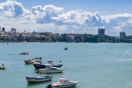
Se realiza un estudio de diseño para el Fondo del Agua de Mombasa mediante la evaluación de los beneficios biofísicos, financieros, económicos y socioeconómicos, y la identificación de posibles modelos de gobernanza y financiación. FutureWater lidera el análisis biofísico del proyecto basado en la cuantificación, mediante modelización hidrológica, de los...
-
Improved Watershed and Forestry Activities to Secure Hydropower
This study supports Gabon in preserving Hydrologic Ecosystem Services in a river basin which faces challenges due to planned hydropower and forestry operations. It will evaluate various watershed management scenarios which may improve hydrological flow conditions and hydropower options. FutureWater analyzes hydrological ecosystem services provision in the Komo basin through...
-
Baseline Assessment for the Identification of Landscape Restoration Options in Kyrgyzstan
FutureWater's role in this project is to provide remote sensing and GIS services with an aim of highlighting degraded areas of land in Kyrgyzstan and determining where restoration interventions are possible. The identification of highly degraded areas is achieved by analysing a number of remote sensing products, notably including NDVI...
-

HiHydroSoil v2.0: Global Maps of Soil Hydraulic Properties at 250m Resolution
In 2016, FutureWater released a new dataset: HiHydroSoil v1.2, containing global maps with a spatial resolution of 1 km of soil hydraulic properties to support hydrological modeling. Since then, the maps of the HiHydroSoil v1.2 database have been used a lot in hydrological modeling throughout the world in numerous (scientific) projects. A few examples of...
-
WAT4CAM: Mekong-Bassac Hydrological and Hydraulic Study
The WAT4CAM program aims to apply IWRM and ISWM principles towards achieving the strategies of the government of Cambodia. This project (WAT4CAM subcompoment 3.1) supports this objective by performing a detailed hydraulic and hydrological modelling study, of which the outcomes will be used in the implementation of Prek rehabilitation works....
-

Training in Hydrology and Water Allocation Modelling for Kenyan Water Resources Professionals
This course on hydrology and water allocation modelling is organized for the Kenya Water Resources Authority (WRA) and funded by the Blue Deal program of the Netherlands. The first four-week course block introduces the participants to the main concepts in hydrology, hydrological modelling and data collection, including remote sensing. Exercises...
-
Climate Risk Assessment for the Li River in China
The Li River basin in China is a basin that is prone to floods because of its mountainous character, narrow floodplains and extreme rainfall events. In 2020, large floods have occurred in this basin when enormous amounts of precipitation were observed in just a few days. A total of 272...
-
Hydrological Assessment for Hydropower in the Lukhra River
The objective was to develop a hydrological assessment for a planned run-of-river hydropower plant in the Lukhra river basin in Georgia. There is no observed river discharge data available. Hence, the assessment was developed based on hydrological simulations of the basin using the SPHY model (Terink et al., 2015) and...
-
Flood Risk Assessment of a Water System Under a Future Climate
In 2009, the former Velt en Vecht Water Board (now part of the Vechtstromen Water Board) and in consultation with the municipalities of Emmen, Coevorden, Hardenberg and Ommen concluded an agreement in which agreements were made about the scope and interpretation of the development of storm water retention areas. This...
-
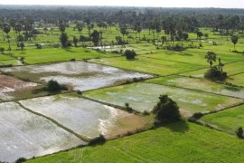
Mavo Diami: Services on Land-crop Suitability Mapping and Operational Irrigation Advice in Angola
The overall project goal is to improve sustainable food and income security for >100,000 smallholder farmers in Angola, by accelerating their agri-business performance through informed decisions supported by the Mavo Diami services built on weather, soil and crop signals and other relevant data and indicators. Ensuring the services are offered...
-
Glacio-hydrological Assessment for Hydropower in the Nakhra River
The objective was to develop a glacio-hydrological assessment for planned run-of-river hydropower plant locations in the Nakhraa river basin in Georgia. The availability of observed river flow data is limited. Hence the assessment was developed based on hydrological simulations of the basin using the SPHY model (Terink et al., 2015)....
-
Glacio-hydrological assessment for hydropower, Mestiachala river, Georgia
The objective of this project was to develop a hydrological assessment for two potential hydropower plant locations in the Mestiachala basin in Georgia. The availability of observed river discharge data is limited. Hence the assessment was developed based on hydrological simulations of the basin using the SPHY model (Terink et...
-
Thought Leader Convening on Water Towers
Scientists from around the world have assessed the planet’s 78 mountain glacier–based water systems and, for the first time, ranked them in order of their importance to adjacent lowland communities, as well as their vulnerability to future environmental and socioeconomic changes. These systems, known as mountain water towers, store and...
-
Improved catchment management for small hydropower
This study assessed the impacts of various investment portfolios for catchment management activities on the cost-benefits of small hydropower schemes, in two case study catchments in Kenya and Tanzania, and analyzes the return-on-investment for the hydropower developers. Catchment degradation trends, climate change impacts and socio-economic changes increasing competing water use...
-
Pan-TPE: Changes in the Pan-Third Pole Water Tower
The proposed research targets changes in climate, water supply and demand, and suitable adaptation measures for green development of the Silk Road Economic Belt (SREB) in the river basins crossed by the SREB transect. Given the strong role of large scale hydrology in the proposed research activities, the spatial domain...
-
Hydrological and water resources assessment for the Muhazi Dam
The current infrastructure at the outlet of the large Muhazi Lake in Rwanda is highly unstable and causes a risk to the surrounding and downsteam inhabitants. The authorities want to improve this situation by building a new dyke. A feasibility and detailed designs study was performed for this new structure....
-
Hydrological assessment for two potential sites for run-of-river hydropower, southwestern Georgia
A hydrological assessment was carried out for two sites where run-of-river hydropower plants are planned, in the southwestern part of Georgia. Only very limited streamflow data were available, so the assessment was based mainly on hydrological modelling of the basin upstream of the points of interest. Principally global datasets were...
-

NL-RIA: Satellite-based altimetry data for hydrological assessments
A Dutch consortium has joined in the project “Dutch network on small spaceborne radar instruments and applications (NL-RIA)”, led by TU Delft. The objective is to bundle the radar-related knowhow available in The Netherlands, and fill the knowledge gaps, in order to boost SmallSat radar-based Earth Observation technology. The task...
-
Hydrological pre-feasibility assessment for a potential hydropower plant, North Sumatra, Indonesia
Following the successful development of hydropower facilities in Indonesia, a new project was established to study the potentials for the development of a hydro-electric power plant in the Tripa Basin, North Sumatra, Indonesia. To make a go/no-go decision of a more detailed feasibility study, a pre-feasibility study is undertaken to...
-
Remote Sensing for Land Suitability Assessment in Angola
The government of Angola considers the agricultural sector as an economic sector that offers great prospects and therefore aims to further develop the agricultural sector in order to diversify its economy. The potential for expanding the area under production is great. To support the effective planning of interventions that increase...
-
Pre-feasibility study of run-of-river hydropower plant, Georgia
There is great potential for hydropower in Georgia. Critical is to conduct accurate feasibility assessments for hydropower generation at the different potential sites of interest. This pre-feasibility assessment delivered daily flow estimates at several locations in Georgia. These flows were used as input into an economic analysis.
-

LAUREL: Land Use Planning for Enhanced Resilience of Landscapes
Deforestation, population growth, and climate change are only some of the challenges to sustainable landscape management in Madagascar. Severe impacts of land degradation on crop production, water availability and biodiversity are already observed and expected to exacerbate in the future. To address these challenges, the World Bank is supporting the...
-
Climate Risk and Vulnerability Assessment of Irrigation in Kazakhstan
The government of Kazakhstan with financial support of the Asian Development Bank (ADB) is planning to upgrade and rehabilitate its irrigation sector. A detailed Climate Risk and Vulnerability Assessment (CRVA) has been undertaken by a consortium led by FutureWater in 2017. The team collected all available data on the project...
-
Cuantificación de la descarga subterránea al Mar Menor
La descarga subterránea procedente de los retornos de riego de origen agrícola hacia el Mar Menor se encuentra entre una de las posibles causas que explican los altos niveles de eutrofización (hipereutrofización) y elevada proliferación de algas alcanzados en este ecosistema lagunar. Una de las alternativas planteadas para reducir las...
-
Modelización de balances de agua y asignación de recursos hídricos en Ruanda
En su esfuerzo por introducir el marco de Gestión Integrada del Territorio y el Agua, el Gobierno de Ruanda a través de la iniciativa “Agua para el crecimiento de Ruanda”, empezó a desarrollar planes de gestión de cuenca. FutureWater apoyó este esfuerzo utilizando el la plataforma de modelización WEAP para...
-
Capacitación técnica en modelización de recursos hídricos para las agencias de gestión del agua de Mozambique
Se implementó un programa de capacitación teórico-práctica diseñada a medida para fortalecer el conocimiento del personal técnico de las agencias del agua de Mozambique (ARA) y fortalecer su capacidad para asesorar a los tomadores de decisión y políticos del agua. La capacitación abarcó los conceptos teóricos sobre modelado hidrológico y...
-
Hydropower Development Assessment for the Tamakoshi River Basin
The overall objective of this project is to improve the understanding of the expected impacts of climate change on water availability in the context of potential hydropower development in the Tamakoshi River Basin. Specifically, the project aims to (i) Understand the current baseline hydrological regime of the Tamakoshi River Basin,...
-
Strategic Basin Planning Ganga River Basin
The World Bank has assigned Deltares and its partners AECOM India and FutureWater to carry out the project ”Analytical Work and Technical Assistance to support Strategic Basin Planning for Ganga River Basin in India”. The key objectives of this project are (i) Significantly strengthen the capability of relevant central and...
-

Review Climate Change Hindu-Kush-Himalaya
FutureWater provided a comprehensive review study on climate change and the impacts on cryosphere, hydrological regimes and glacier lakes in the Indus, Ganges, and Brahmaputra river basins. This review study was done in the context of future hydropower development in the region.
-
Demonstration of Remote Sensing Information for Integrated Reservoir Management in the Red River Basin in Northern Vietnam
In 2011 the Vietnamese and Dutch government signed a Memorandum of Understanding on the establishment of a Government to Government (G2G) program for improved integrated planning and monitoring of water resources for transboundary water management and disaster risk management. This project was formulated as part of the G2G trajectory towards...
-

HI-AWARE: Himalayan Adaptation, Water and Resilience
HI-AWARE aims to contribute to enhanced adaptive capacities and climate resilience of the poor and vulnerable women, men, and children living in the mountains and flood plains of the Indus, Ganges, and Brahmaputra river basins. Research, including modeling, scoping studies, action research, and randomized control trials, is conducted at 12...
-
Central Asia Regional Risk Assessment for Water Related Energy Sector Impacts
The objective of this study was to support the “Central Asia Regional Energy Sector Vulnerability Study” led by Industrial Economics (IEc) and funded by the World Bank, by carrying out an expanded risk assessment for water availability and water related energy sector impacts in Central Asia. The work built on...
-
OWASIS-UK: Observatory of Water Availability – System of Integrated Services
The main objective of this study is to explore the potential to combine optical and gravity data from Earth Observation with meteorological data, together with innovative in situ sensors, hydrological modelling and crowd sourcing technologies, and the advanced visualization of the information through situation awareness platforms and decision support tools,...
-
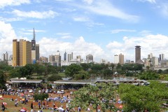
The Nairobi Water Fund: hydrologic modelling and economic valuation of investment options
In 2013 The Nature Conservancy (TNC) started working to launch the first Water Fund in Africa to restore and protect the condition of the Tana River and improve Nairobi’s water security. Key questions that needed to be answered were “Where and in what activities should the fund invest its money?”...
-
Gridded Meteorological Datasets and Hydrological Modelling in the Upper Indus Basin
Understanding of the hydrological regimes in the mountainous Upper Indus basin (UIB) is essential for water resources management in the region. High-resolution gridded meteorological datasets, which capture the spatial variability of precipitation, are critical for modelling the hydrology of high-mountain regions. Improvements to existing gridded datasets using high-elevation station data...
-
Herramientas para la evaluación de la seguridad hídrica de Colombia y posibilidades de adaptación al cambio climático
En 2011, la cuenca del Río Magdalena en Colombia fue severamente afectada por grandes inundaciones, a la misma vez que ciertas regiones de la misma padecían situaciones de severa sequía y escasez hídrica. El objetivo general del proyecto fue brindar un conjunto de herramientas de para la evaluación de los...
-
Online field-scale irrigation management for Romania
In this project a field-scale irrigation planning and management system was setup and tested. The basis for this system is formed by online in-situ ground data on soil moisture content and hydrological model calculations of the root zone and shallow subsoil. Weather stations and soil moisture sensors were installed at...
-
Monitoring of Glacier, Climate and Runoff in the Hindu – Kush Himalayan Mountains
For this project a review was conducted of current state of knowledge in (i) climate change datasets and downscaling used for glacier and high mountain modelling, (ii) glacier and snow contribution to river runoff in the Hindu – Kush Himalayan (HKH) region, (iii) hydrological modelling studies used for glacier and...
-
Assessment of the Irrigation Potential in Nile Countries in Central Africa
In order to fill gaps in the Nile Basin Initiative and member country information bases on agricultural water use the irrigation potential of seven Nile countries was assessed. This project consisted of several consecutive steps, in which hydrological modelling, the use of remote sensed data, ArcGIS analyses, consultation workshops and...
-
Irrigation Potential Lake Victoria, Tanzania
A study was undertaken to evaluate and rank five potential irrigation schemes in the Tanzania part of the Lake Victoria Basin. The study focused on the following five thematic areas: (i) land suitability, (ii) water resources assessment, (iii) water requirements, (iv) environmental considerations, and (v) institutional aspects.
-
Mekong River Basin Modeling Framework Development
The Mekong River Commission (MRC) Information and Knowledge Management Programme (IKMP) is developing and expanding its modeling framework. FutureWater was asked to support the process by developing a complete strategy and to prepare a set of tender documents for implementation of the strategy. The project resulted in six specific Program...
-
Remote Sensing and Hydrological Modelling of the Rio Bravo, Aguascalientes and Central Northern Valleys
The project has shown how modern analytical tools such Remote Sensing, GIS and simulation models can help to swiftly obtain data to support the water management decision making process. A diagnosis of the Rio Bravo and Northern Central Aquifers has been made to demonstrate management options as well as how...