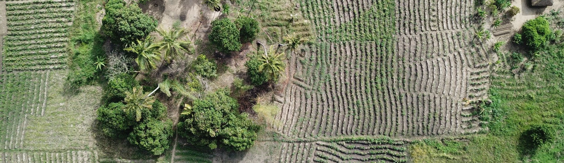
In this project TerraFirma hired FutureWater, HiView and ThirdEye Limitada (Chimoio, Mozambique) to acquire flying sensor imagery over a pilot area near Quelimane, Mozambique. The objective of this pilot project is to determine the suitability of using flying sensor imagery for cadastre mapping in an area of small-scale agriculture in Mozambique. The flying sensor imagery was acquired over the period of a few days in December 2020, for a total area of 1,120 hectares.
The practice of using remote sensing imagery is becoming more widespread. However, the suitability of satellite or flying sensor imagery needs to be evaluated by location. Satellite imagery is available at different price ranges and is fixed in terms of spatial and temporal resolution.
TerraFirma, an organization in Mozambique with the task to map and document land rights, hired FutureWater, HiView and ThirdEye Limitada (Chimoio, Mozambique) to acquire flying sensor imagery over a pilot area near Quelimane, Mozambique. The objective of this pilot project is to determine the suitability of using flying sensor imagery for cadastre mapping in an area of small-scale agriculture in Mozambique.
Flying sensor imagery is adaptable and can be deployed at any requested time. The suitability of these remote sensing approaches is piloted in this study for a small-scale agricultural area in Mozambique. A pilot area is used as case study with flights made during a period of a few days in December 2020, by local flying sensor (drone) operators in Mozambique (ThirdEye Limitada).
The flying sensor imagery was acquired over the period of a few days in December 2020, for a total area of 1,120 hectares. This imagery was used as input for various algorithms that can be suitable for classification and segmentation, namely R packages (kmeans, canny edges, superpixels, contours), QGIS GRASS segmentation package, and ilastik software. This study shows some initial results of using flying sensor imagery in combination with these algorithms. In addition, comparison is made with high resolution satellite imagery (commercial and publicly available) to indicate the differences in processing and results.
With the conclusions from this pilot project, next steps can be made in using flying sensor imagery or high resolution satellite imagery for small-scale agriculture in Mozambique. The time and effort needed for the delineation of field boundaries can be largely reduced by using remote sensing imagery and algorithms for automatic classification and segmentation.
Publicaciones relacionadas
2021 - FutureWater Report 220
 Van Opstal, J., J. Beard. 2020. Cadastre mapping with flying sensors and satellite imagery in Zambezia, Mozambique. FutureWater Report 220.X
Cadastre mapping with flying sensors and satellite imagery in Zambezia, Mozambique
Van Opstal, J., J. Beard