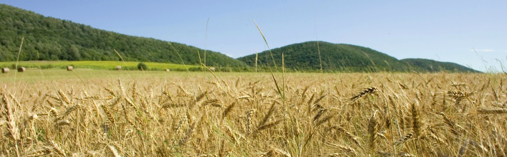
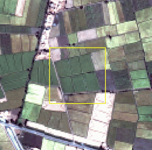
The objective of this project was to evaluate the added value of high-resolution above coarse-resolution remote sensing images in crop yield forecasting. This is especially relevant if the focus is on small-scale farming where the distribution of crop types is often extremely heterogeneous. For this study the Soil-Water-Atmosphere-Plant (SWAP) model was used in combination with LAIs and crop factors (KCs) which were retrieved from remote sensing. Subsequently the SWAP model was run for i) a representative MODIS pixel (coarse-resolution), containing a mixture of berseem, wheat, build-up area, and another crop, and ii) for 256 ASTER pixels (high-resolution) in which each pixel represents a unique land-use class within that MODIS pixel. The test area for this project was the Meet Yazid command area in Egypt.
Crop growth models play a major role in sustaining the world-wide food security. These models are used to simulate crop growth during the growing season, and to forecast final crop yields at the end of the growing season. These crop growth models provide the farmer with the option to simulate certain farm management measures (e.g. irrigation frequency, irrigation depth), in order to evaluate the effect of these measures on the final crop yield. Also commodity traders use this information to support their decision making. For accurate crop yield forecasting, crop growth models are highly dependent on the quality of the spatial and temporal input data.
If the uncertainty in the spatial variation of soil properties, initial soil conditions, crop parameters, and meteorological forcing is small, then crop growth models are capable of simulating crop yields quite accurately. Since crop yield forecasting applications are often applied over large areas that rely on a spatially distributed crop growth model, the uncertainty in the spatial variation of the input data increases. This uncertainty is reflected in crop models in the simulation of the crop canopy development, which determines light interception and the potential for photosynthesis. It also influences the simulation of the soil moisture content, which determines the actual transpiration and reduction of photosynthesis as a result of drought stress.
Nowadays, remote sensing images from satellites are often used in crop growth models to improve the simulation of these processes, because remote sensing images provide spatially distributed input data to these models. Data that can be obtained from remote sensing is e.g. the Leaf-Area-Index (LAI), crop yield and biomass. Remote sensing images are available in numerous spatial resolutions, where coarse resolution images are often freely available compared to the more expensive high-resolution images.
The objective of this project is to evaluate the added value of high-resolution above coarse-resolution remote sensing images in crop yield forecasting. This question is especially relevant if the focus is on small-scale farming where the distribution of crop types is often extremely heterogeneous; meaning that the uncertainty in the spatially distributed model input parameters (soil properties, crop parameters, etc.) becomes larger. FutureWater undertakes this project in collaboration with the Soil Physics and Land Management Group of Wageningen University and eLeaf. For the current study we will use the Soil-Water-Atmosphere-Plant (SWAP) model in combination with LAIs and crop factors (KCs) which were retrieved from remote sensing. Subsequently the SWAP model will be run for i) a representative MODIS pixel (coarse-resolution), containing a mixture of berseem, wheat, build-up area, and another crop, and ii) for 256 ASTER pixels (high-resolution) in which each pixel represents a unique land-use class within that MODIS pixel. The test area for this project is the Meet Yazid command area in Egypt.
The final result of this project will answer the question whether high-resolution remote sensing images in combination with the SWAP model result in improved crop yield forecasts. Moreover the project will generate practical directions to the application of the developed methodology under various conditions including small scale rainfed farmers.
Publicaciones relacionadas
2013 - Advances in Data Mining, Workshop Proceedings
 Terink, W., P. Droogers, J. van Dam, G. Simons, M. Voogt, A. Ines. 2013. Satellite based data mining to support Egypt's agriculture. Advances in Data Mining, Workshop Proceedings, ICDM 2013, pp. 171-180. ISSN 1164 - 9734. ISBN 978-3-942952-23-1X
Satellite based data mining to support Egypt’s agriculture
Terink, W., P. Droogers, J. van Dam, G. Simons, M. Voogt, A. Ines
2012 - FutureWater Report 116
Terink, W., P. Droogers, J. van Dam, G. Simons, M. Voogt. 2012. The added value of high-resolution above coarse-resolution remote sensing images in crop yield forecasting: a case study in the Egyptian Nile Delta. FutureWater Report 116XThe added value of high-resolution above coarse-resolution remote sensing images in crop yield forecasting: a case study in the Egyptian Nile Delta
Terink, W., P. Droogers, J. van Dam, G. Simons, M. Voogt
