The PROMAC II project is an ongoing project of NCBA Clusa introducing conservation farming practices to various locations in the Manica, Tete and Zambezia provinces, with the objective to increase agricultural productivity. This project incorporates flying sensor activities in the PROMAC II project as a M&E indicator of the practices and as an innovative technology for providing technical staff with spatial information on crop development. Flying sensor imagery can provide data at regular intervals with high spatial resolution and an additional camera for vegetation stress detection. This information is used to analyze the productivity of selected areas. Flying Sensor technology will be used to support the PROMAC II project with data collection on crop development and comparative analysis between areas with traditional practices vs. conservation agriculture practices.
The scope of the project work is as follows:
- Train selected NCBA Clusa PROMAC staff on drone operation, imagery processing software, and crop monitoring;
- Provide technical assistance to trained NCBA Clusa staff on drone operation, imagery processing, and interpretation of crop monitoring data;
- Present technical reports on crop development and land productivity (i.e. crop yield) at the end of the rainy and dry season
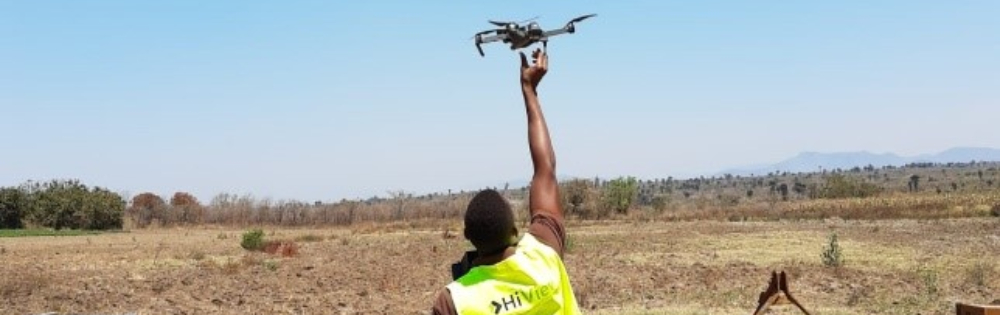
The trainings and technical assistance for the NCBA Clusa staff are provided in collaboration with project partners HiView (The Netherlands) and ThirdEye Limitada (Central Mozambique). Technical staff of the NCBA Clusa are trained in using the Flying Sensors (drones) in making flights, processing and interpreting the vegetation status camera images. This camera makes use of the Near-Infrared wavelength to detect stressed conditions in the vegetation. Maps of the vegetation status are used in the field (with an app) to determine the causes of the stressed conditions: water shortage, nutrient shortage, pests or diseases, etc. This information provides the NCBA Clusa technical staff and extension workers with relevant spatial information to assist their work in providing tailored information to local farmers.
At the end of the growing season the flying sensor images are compiled to report on the crop development. The imagery in combination with a crop growth simulation model is used to calculate the crop yield and determine the magnitude of impact the conservation agriculture interventions have in contrast with traditional agricultural practices.
Publicaciones relacionadas
2020 - FutureWater Report 214
 Van Opstal, J., J. Beard, M. de Klerk, 2020. Analysis of the Agricultural Crop Productivity Using Flying Sensors. Technical report - Horticultural season 2020. FutureWater Report 214.X
Analysis of the Agricultural Crop Productivity Using Flying Sensors: Horticultural season 2020
Van Opstal, J., J. Beard, M. de Klerk
2020 - FutureWater Report
Van Opstal, J. 2020. Incorporation flying sensors in NCBA Clusa’s project in Manica, Mozambique - Final report. FutureWater Report.X
Incorporation flying sensors in NCBA Clusa’s project in Manica, Mozambique – Final report
Van Opstal, J.
2020 - Infographic
Van Opstal, J., J. Beard, M. de Klerk, 2020. Analysis of the Agricultural Crop Productivity Using Flying Sensors - InfographicXAnalysis of the Agricultural Crop Productivity Using Flying Sensors – Infographic
Van Opstal, J., J. Beard, M. de Klerk
2020 - FutureWater Report 203
Van Opstal, J., J. Beard, M. de Klerk, 2020. Analysis of the Agricultural Crop Productivity Using Flying Sensors. Technical report - Rainy season 2019-2020. FutureWater Report 203.XAnalysis of the Agricultural Crop Productivity Using Flying Sensors: Rainy season 2019-2020
Van Opstal, J., J. Beard, M. de Klerk
