FutureWater travelled to Mashhad, Iran to undertake a series of key activities related to the SMART-WADI project (SMART Water Decisions for Iran) with the main goal of testing drone flights and imagery recovery from agricultural fields.
The SMART-WADI project (SMART Water Decisions for Iran), carried out by a consortium of FutureWater, IHE-Delft, and local partner EWERI, focuses on farmers who irrigate their crops with groundwater. The aim is to provide advice on irrigation, water productivity, and farm management using information from flying sensors (drones), satellites and crop models.
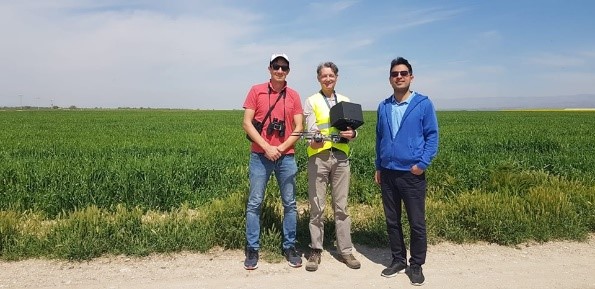
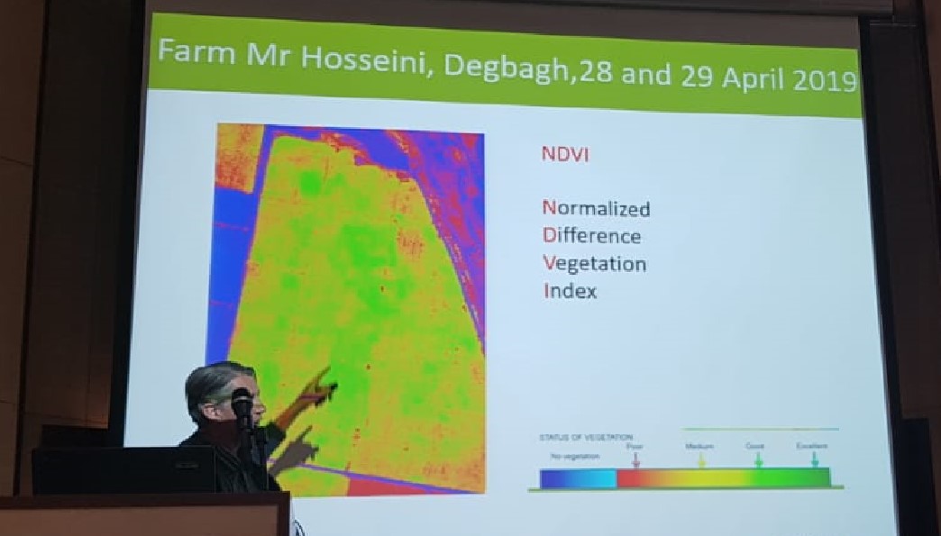
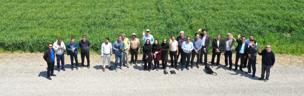
We successfully used flying sensors to obtain relevant images and information from agricultural fields in Dehbagh located 60 km from Mashhad (Figure 1). Farmers showed special interest when we derived vegetation maps indicating localized damage in their wheat plots (Figure 2). We had the opportunity to meet and discuss with several stakeholders, farmers, government institutions (basin authority and agricultural organization) and private flying sensor companies about the potential service implementation using remote sensing technologies in agriculture.
Also, a seminar was organized in the Ferdowsi University showing preliminary results of the project and future perspectives with additional participation of academic staff, students and the coverage of a national TV station.
SMART-WADI is a feasibility project, in which the market context and technical aspects are tested for a potential service. This is supported by the Partners for Water Program of RVO.nl, with co-funding from the executive project partners. Based on the first signals and the experiences collected in this visit, it is estimated that remote sensing services has great potential to be scaled up to other areas in Iran. A second trip is planned in August.