El proyecto BUCRA (Building Unity for Climate Resilient Agriculture) tiene como objetivo fortalecer la resiliencia agrícola en Qahbunah, una comunidad agrícola ubicada en el delta del Nilo, en Egipto. Los agricultores locales se enfrentan a crecientes desafíos como la escasez de agua, el cambio climático y la fragmentación de la tierra, lo que genera una necesidad urgente de soluciones innovadoras y prácticas para asegurar sus medios de vida.
En el corazón de BUCRA se encuentra Croptimal, desarrollado por FutureWater. Croptimal integra tecnologías avanzadas basadas en datos con conocimientos agrícolas locales para apoyar a los agricultores en la toma de decisiones más inteligentes y resilientes al clima.
Croptimal es una herramienta de análisis de idoneidad climática que combina proyecciones climáticas, datos geoespaciales y experiencia agrícola para evaluar la adecuación de distintos cultivos bajo condiciones climáticas actuales y futuras. Al identificar los cultivos y zonas más resistentes a factores de estrés como el calor, la salinidad y la escasez de agua, Croptimal proporciona recomendaciones claras y basadas en datos para la selección de cultivos y la planificación agrícola. La herramienta ofrece mapas detallados y consejos prácticos que ayudan a los agricultores a adaptarse al cambio climático y a mejorar su productividad.
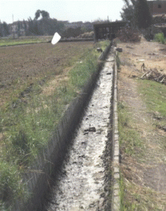
Como complemento a Croptimal, BUCRA incorpora asesoramiento inteligente en riego para mejorar la eficiencia en el uso del agua. A partir de datos satelitales de código abierto, información meteorológica en tiempo real y condiciones locales del suelo, los agricultores reciben recomendaciones diarias de riego. Estas se envían directamente por WhatsApp, lo que garantiza que el servicio sea accesible, práctico y rentable. Este enfoque reduce el consumo de agua y energía, al tiempo que mantiene o incrementa los rendimientos agrícolas, un beneficio clave en el delta del Nilo, donde el agua es cada vez más escasa.
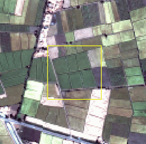
Además de las herramientas digitales, BUCRA incluye parcelas demostrativas donde se muestran prácticas agrícolas climáticamente inteligentes, como el riego eficiente, la gestión sostenible del suelo y la rotación de cultivos. Los agricultores participan en un programa de aprendizaje combinado, que integra capacitación práctica en campo con aplicaciones digitales fáciles de usar.
BUCRA también pone un fuerte énfasis en el empoderamiento de jóvenes y mujeres, el fortalecimiento de los vínculos con los mercados y la promoción de un uso sostenible de la tierra. Al alinear la experiencia neerlandesa con las necesidades locales, el proyecto busca aumentar la productividad, estabilizar los ingresos y construir un futuro agrícola más sostenible para Qahbunah.
La visión a largo plazo es fomentar una adopción más amplia de estas herramientas y prácticas en la región, contribuyendo así a la seguridad alimentaria y del agua, y enfrentando los desafíos del cambio climático.
La aplicación Croptimal está disponible en Croptimal.app. Póngase en contacto con nosotros si desea más información o solicitar su propia cuenta.
Vídeo: Croptimal – Asesoramiento inteligente de riego impulsado por datos