The Nile Basin Decision Support System (NBI-DSS) will provide the necessary knowledge base and analytical tools to support the planning of cooperative joint projects and the management of the shared Nile Basin water resources on an equitable, efficient and sustainable manner. FutureWater was asked to support this NBI-DSS and to undertake preliminary data collection and compilation.
Details
The developed data base has two main components: spatial data and point data. Regarding the spatial data the following data have been made available
Land cover
Soils
Vegetation Indices
Precipitation FEWS
These data are available over the entire Nile Basin and include a extensive set of attributes. Data have been quality controlled and is ready to apply in the DSS and can be used for various types of hydrological models.
The point data includes over 20 million records from various sources included global and local data sets. Data are stored in PostGreSQL. The data can be considered as the most complete hydro-meteorological dataset available for the Nile so far.
Kenate River is one of the permanent streams draining the Imatong Mountains at the southern border of South Sudan. Administratively the river’s catchment area falls within Torit, Lopa/Lafon and Ikotos Counties of Equatoria State (EES). Torit Township a fast growing urban centre and its demand for domestic water development is sharply increasing. With the settlement of returnees throughout Kenate Catchment also the demand for rural water supply water is growing fast. As a result of uncontrolled opening of new farms in the upper Kenate Catchment, the vegetation cover in the better rainfall areas is under pressure. This together with the fact that valley bottom farming is upcoming in the middle Kenate Catchment , makes that the water supply of downstream population is at risk of deregulation.
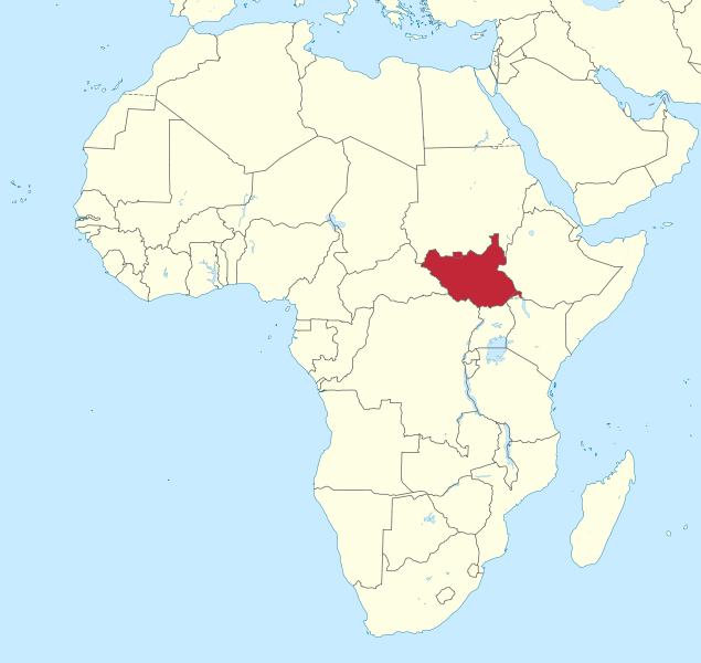
South Sudan
As there is an urgent need for informed decision making in ongoing and upcoming land and water resource development plans, the governments of South Sudan and the Netherlands (GoN) initiated a program for the Water Sector in Eastern Equatoria State (ProWasEES). It aims to contribute to a situation whereby: i) water-related natural resource conflicts are minimized and ii) the population of EES have access to safe drinking water and certified sanitation facilities. Focus will be on the Kenate River which is one of the permanent streams draining the Imatong Mountains at the southern border of South Sudan. Kenate Basin falls within Torit, Lopa/Lafon and Ikotos Counties of Equatoria State. The overall objective of this program is that “Kenate Watershed is managed in an integrated and sustained manner”.
In order to reach this objective there is an urgent need for an integrated land and water resource management (ILWRM) model for scenario development, which FutureWater will develop. Initially it will operate with a limited amount of local data, combined with global public domain data. Data collection for further fine-tuning can follow during operationalizing of the model.
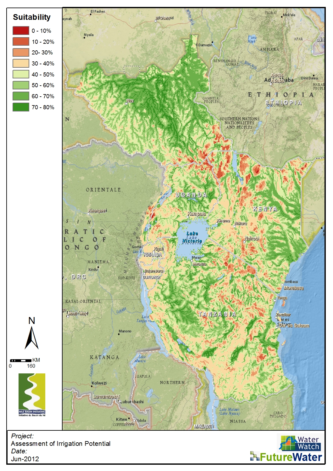
Los países incluidos en las subcuencas de los lagos ecuatoriales del Nilo se enfrentan a una creciente presión sobre la tierra y los recursos hídricos, unida al rápido crecimiento demográfico. Por ello, la producción de alimentos es una de las principales preocupaciones y prioridades de los responsables políticos de la zona. El regadío y la mejora de la gestión del agua tienen el potencial de impulsar la productividad agrícola en la zona, que en la actualidad es casi totalmente de secano. El rendimiento de los cultivos de regadío es muy superior al de los cultivos de secano, lo que significa que existe un gran potencial para aumentar la producción de alimentos en la zona.
FutureWater, en colaboración con WaterWatch, evaluará el potencial de regadío de siete países del Nilo con el fin de colmar las lagunas existentes en la información del NBI y de los países miembros basada en el uso agrícola. Este estudio consta de varias etapas consecutivas, en las que la modelización hidrológica, el uso de datos obtenidos por teledetección, los análisis ArcGIS, los talleres de consulta y las reuniones constituyen el núcleo del proyecto.
Los objetivos específicos de este proyecto son:
Determinar el potencial de riego de los países propuestos teniendo en cuenta los recursos físicos de «suelo» y «agua», combinados con las necesidades de agua de riego determinadas por los patrones de cultivo y el clima
Proporcionar una evaluación preliminar de las posibles limitaciones medioambientales y socioeconómicas que deben tenerse en cuenta para garantizar el uso sostenible de los recursos físicos de la cuenca del Nilo
Indicar los recursos necesarios para la fase de preparación e inversión
Mapas
La evaluación del estudio del potencial de riego dio lugar a un mapa de idoneidad para el riego. Este mapa puede descargarse como jpeg o como GeoTIFF. Haga clic en los enlaces siguientes para descargar el formato adecuado:

