Nepal ofrece un terreno de pruebas ideal debido al fuerte apoyo gubernamental a la agricultura climáticamente inteligente, una gran población de pequeños agricultores vulnerables y la participación activa de organizaciones como el Centro de Investigación sobre la Resiliencia Climática (CRRC) y el Centro Internacional para el Desarrollo Integrado de las Montañas (ICIMOD). Los resultados de esta viabilidad respaldarán los objetivos de las políticas nacionales y podrán extenderse a regiones montañosas similares del sur de Asia.
Este proyecto se centra en el distrito de Syangja, en la provincia de Gandaki, que se enfrenta a una creciente escasez de agua y a precipitaciones impredecibles, especialmente en las explotaciones agrícolas de ladera que dependen del riego por manantial y de la agricultura de secano. Estas condiciones hacen inviable el riego tradicional y crean la necesidad de soluciones de baja presión, asequibles y adaptables localmente. El pulverizador inteligente combina un hardware práctico con una herramienta digital de asesoramiento para optimizar el uso limitado del agua: una innovación frugal adaptada a las necesidades de los pequeños agricultores.
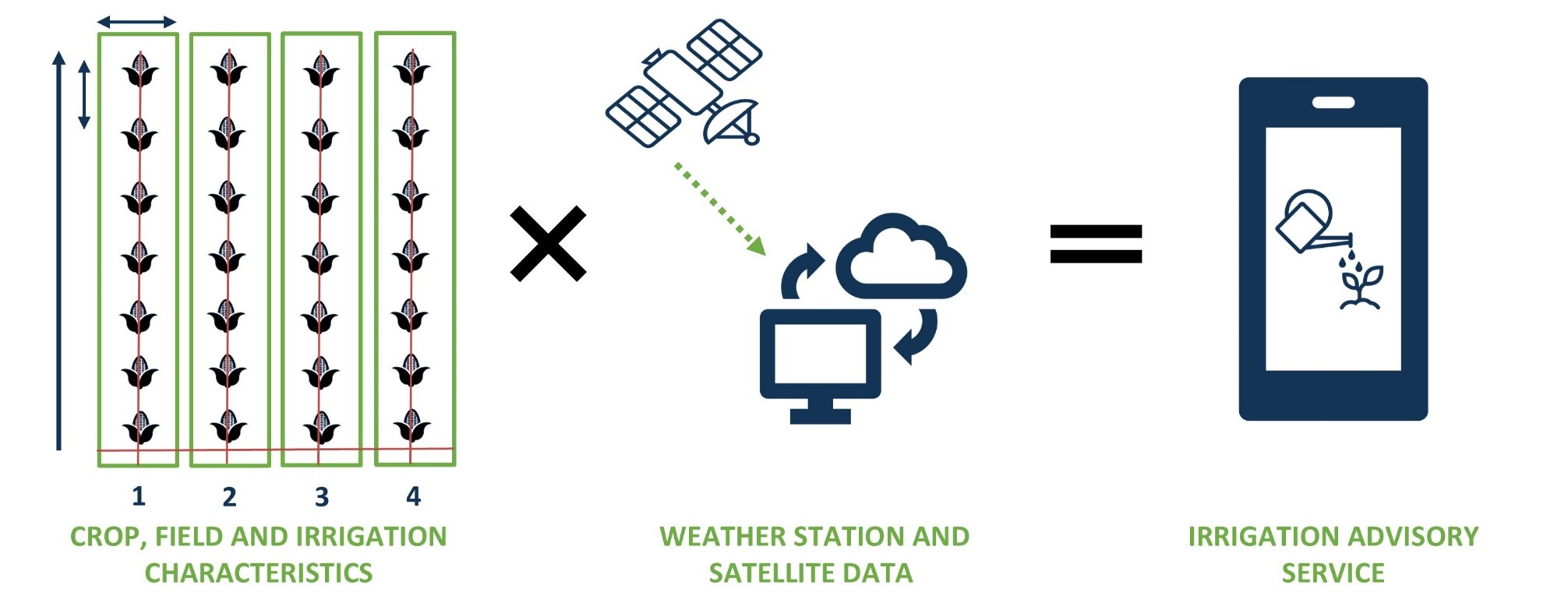
El proyecto implica la viabilidad de un sistema de riego integrado y de bajo coste «Smart Sprayer» basado en SOSIA pero adaptado a la agricultura de ladera que ofrece consejos prácticos de riego por WhatsApp/SMS. La principal innovación es el pulverizador inteligente, un dispositivo de riego de micropivote de baja presión alimentado por gravedad que se combina con una herramienta de riego inteligente adaptada. La plataforma digital ofrece asesoramiento diario sobre riego basado en datos a los teléfonos de los agricultores. Juntos, ofrecen un paquete escalable y rentable para un uso preciso y eficiente del agua en explotaciones situadas en laderas remotas.
El objetivo principal es mejorar la seguridad hídrica y la productividad agrícola de los pequeños agricultores de media montaña durante la estación seca en Nepal. Más concretamente, demostrar la viabilidad técnica, económica y social de una solución de riego de baja presión en combinación con el asesoramiento sobre riego basado en datos de teledetección y previsiones meteorológicas. Esto incluye la investigación de mercado y el desarrollo de casos de negocio tanto para los agricultores como para los proveedores locales.