The purpose of this study is to support The Nature Conservancy in its effort in a first level scoping assessment on erosion levels in the Tuungane project area in Tanzania. Hydrological modelling is used to quantify erosion patterns and its relations with land use and management in a number of pilot watersheds. This scoping modeling study was carried out using gathered data by TNC on land use and climate and other local data.
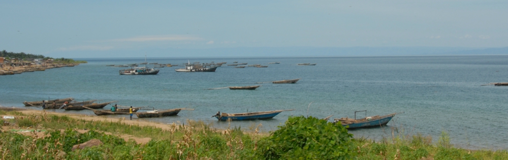
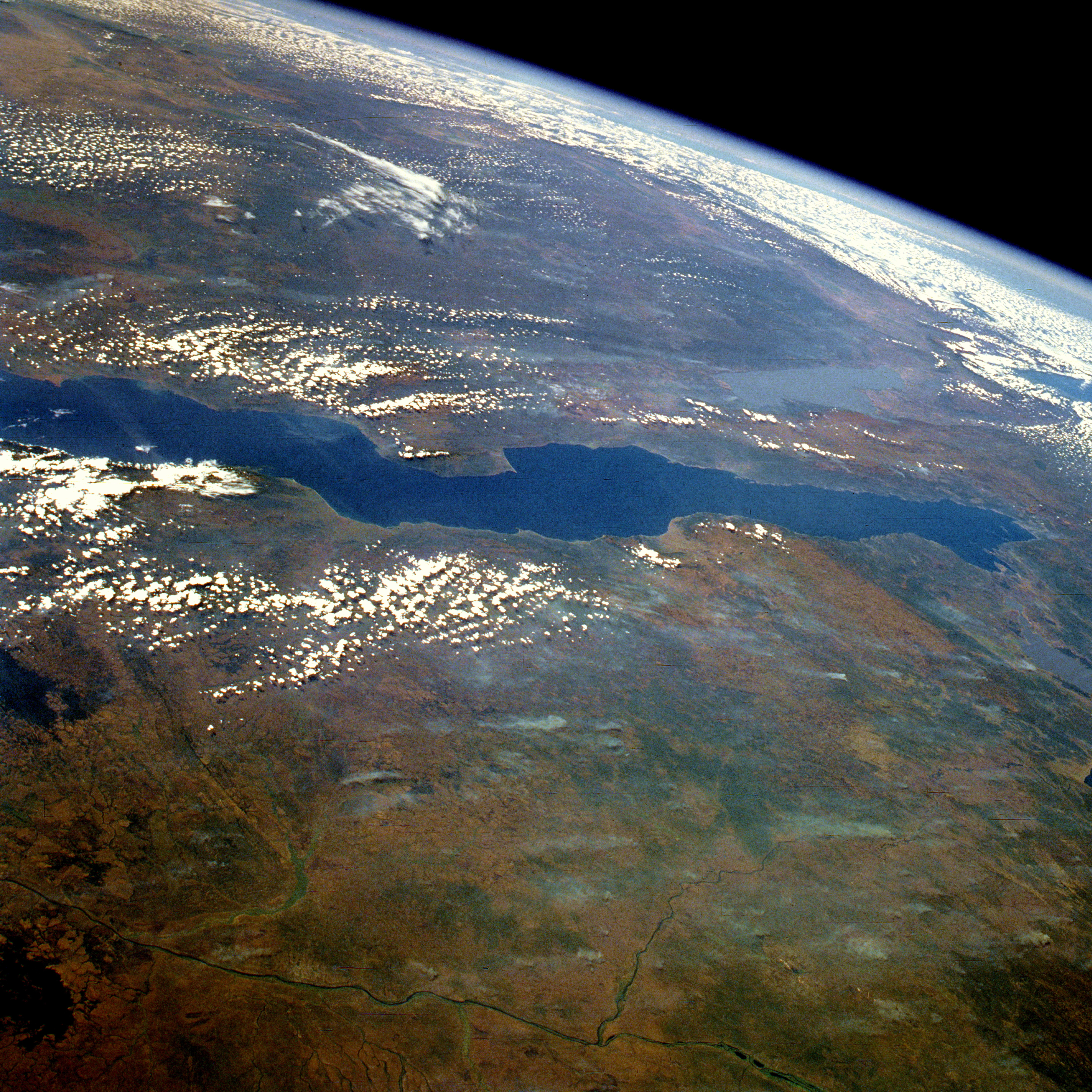
The world’s longest lake, Tanganyika holds 17 percent of our planet’s fresh water and boasts more than 300 fish species. The Greater Mahale Ecosystem encompasses 4.8 million acres of mostly forested landscape and is home to approximately 93 percent of Tanzania’s 2,800 endangered chimpanzees. Local communities of small-scale farmers and fishers still live close to the land, and their lives and livelihoods are dependent upon the area’s rich natural resources.
The health of this diverse natural environment and the well-being of its people are threatened extreme poverty compounded by a rapidly growing human population. For this reason, TNC has started in 2013 the Tuungane Project: Uniting People and Nature. The goal of the project is to provide to remote villages better access to health services, education and modern contraception to achieve a more sustainable use by the population of the natural resources.
Land use change over the last decades has caused forest to be cleared for agriculture, and erosion is considered an increasing problem in the watersheds draining to Lake Tanganyika for the loss of fertility upstream but more important for its likely impact on the fishery habitat in the lake. This is likely one of the causes of the declined fisheries in the coastal zones with its negative consequences on the local communities.
The purpose of this consultancy is to support TNC in its effort in a first level scoping assessment on erosion levels in the Tuungane project area. FutureWater will carry out erosion and hydrological modelling to quantify erosion patterns in a number of pilot erosion modelling watersheds and its relations with land use and management. This scoping modeling study will be carried out using gathered data by TNC on land use and climate and other local data.
The specific objectives for the assignment are:
- Provide a first level assessment of the erosion and sediment yield levels of selected priority watersheds in the project area
- Analyze spatial patterns and its relation with land use management
- Obtain an estimate of the range in temporal variability in sediment yield entering the lake for subsequent analysis on fish habitat impacts.
- Outline and advise on further activities in terms of more details, expansion to other watersheds and potential interventions.
Publicaciones relacionadas
2015 - FutureWater Report 148
 Hunink, J.E., W. Terink, S. Contreras, P. Droogers. 2015. Scoping Assessment of Erosion Levels for the Mahale region, Lake Tanganyika, Tanzania. FutureWater Report 148X
Scoping Assessment of Erosion Levels for the Mahale region, Lake Tanganyika, Tanzania
Hunink, J.E., W. Terink, S. Contreras, P. Droogers
