En noviembre, la sesión anual de la comunidad SPHY reunió a los usuarios del modelo Spatial Processes in HYdrology (SPHY). La sesión sirvió de plataforma para compartir la evolución del modelo, los avances metodológicos y los estudios de casos aplicados en distintos contextos.
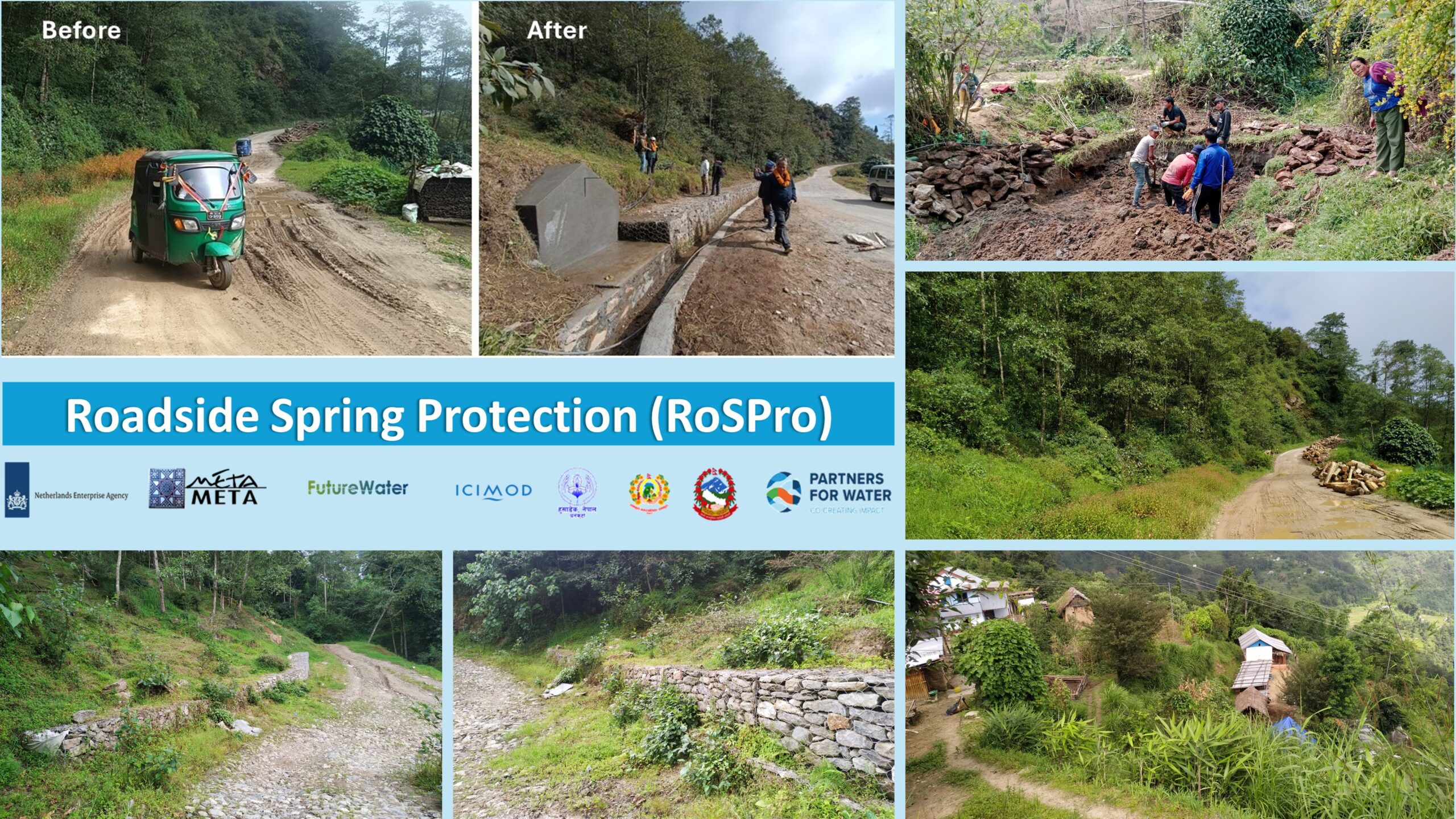
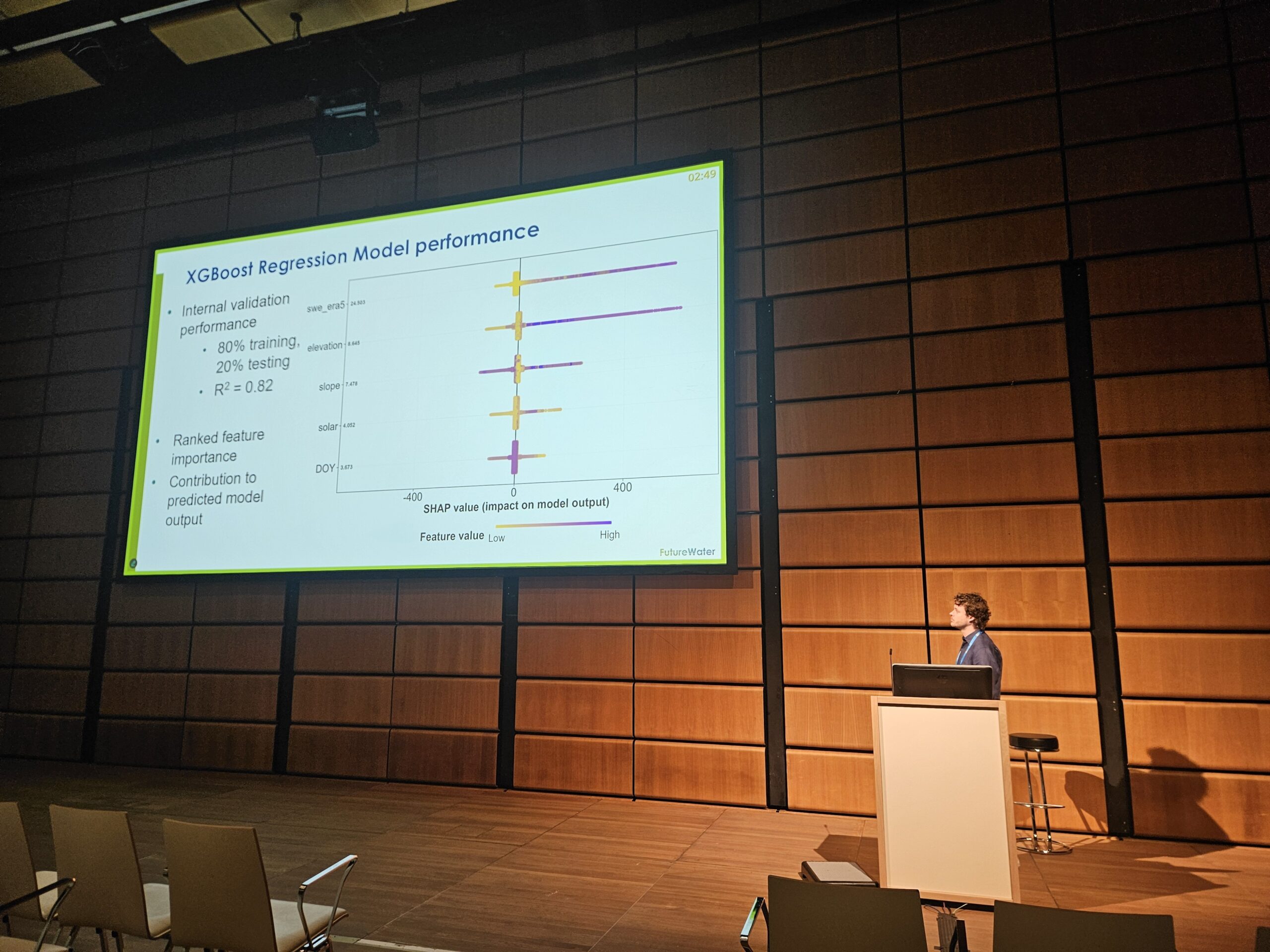
La sesión anual de la comunidad SPHY se inauguró con una actualización de la nueva versión 3.1 de SPHY presentada por Tijmen Schults. El Dr. Johannes Hunink reflexionó sobre la historia de SPHY y su uso en la consultoría basada en la investigación, tras lo cual Amelia Fernández Rodríguez presentó el nuevo plugin SPHY QGIS 3, demostrando cómo SPHY está ahora integrado y accesible en la última versión de QGIS. A continuación, investigadores y profesionales de varios institutos presentaron sus trabajos utilizando SPHY en diferentes contextos. El Dr. Faiz Mohammed compartió un enfoque socio-hidrológico basado en agentes para apoyar inversiones sostenibles y equitativas en la gestión del agua, mientras que el Dr. Joris Eekhout discutió cómo los cambios futuros en el suministro y la demanda de agua de riego pueden afectar a la seguridad hídrica en una cuenca mediterránea. Pranisha Pokhrel presentó su aplicación de SPHY en la cuenca del río Karnali, en Nepal, y la sesión concluyó con una presentación de Tijmen Schults sobre la simulación de la descarga de manantiales en el marco del proyecto de protección de manantiales al borde de la carretera, en Nepal.
La sesión reflejó la creciente y diversa comunidad de usuarios de SPHY y la importancia de un intercambio continuo entre la investigación y la práctica. Agradecemos a todos los ponentes y participantes sus contribuciones y su compromiso, que contribuyen a seguir desarrollando el modelo SPHY. La próxima Sesión Comunitaria de SPHY se celebrará en noviembre de 2026.