![]()
Introducción
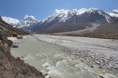
SPHY (Spatial Processes in Hydrology) es un modelo conceptual de balance hídrico distribuido espacialmente (basado en raster) del tipo «leaky-bucket». Integra los procesos hidrológicos dominantes, incluyendo:
- Lluvia-escorrentía
- Desagüe de lagos y embalses
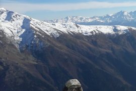
- Procesos criosféricos (nieve, hielo, glaciares)
- Evapotranspiración
- Procesos hidrológicos del suelo
SPHY ha evolucionado con el tiempo incorporando los mejores componentes de modelos de simulación bien establecidos, como SRM, VIC, HydroS, SWAT, PCR-GLOBWB, SWAP y HimSim. Capta los procesos hidrológicos terrestres relevantes a través de varias escalas espaciales (local, regional y global) y es adaptable a diferentes cambios en el uso del suelo, condiciones meteorológicas extremas y escenarios climáticos.
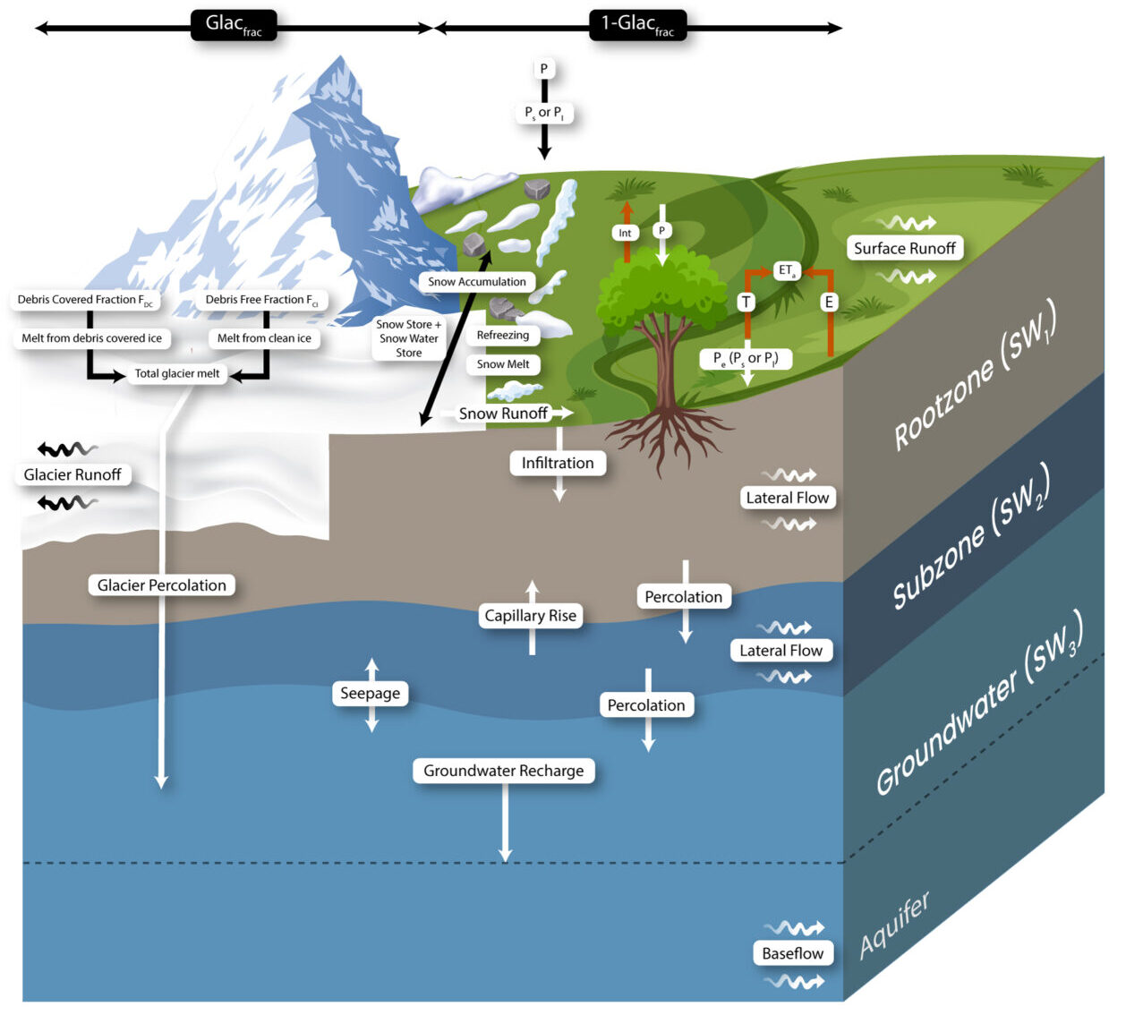
En la figura siguiente se ilustra una visión general de los conceptos del modelo SPHY:
Características principales
La conservación de la masa es el principio básico del modelo SPHY. Los procesos hidrológicos dominantes se definen mediante ecuaciones físicas y parámetros. El modelo emplea un enfoque de variabilidad de subcuadrícula para representar con precisión los procesos a escala fina. Cada celda del modelo puede ser:
- Sin glaciares
- Parcialmente glaciarizada
- Completamente cubierta por glaciares
Las celdas no glaciarizadas pueden incluir diferentes tipos de uso del suelo. La variabilidad de la submalla está influida principalmente por la cobertura vegetal fraccional, que afecta a procesos como la interceptación, la precipitación efectiva y la evapotranspiración potencial.
El modelo divide la columna suelo/tierra en:
- Dos almacenes superiores de suelo
- Un tercer almacén de agua subterránea
Cada depósito tiene sus correspondientes componentes de drenaje: escorrentía superficial, flujo lateral y flujo de base. El deshielo de los glaciares contribuye a la descarga fluvial a través de dos vías:
- Componente lento: Percolación en el depósito de aguas subterráneas, que acaba convirtiéndose en flujo de base.
- Componente rápido: Escorrentía directa.
Capacidades del modelo
SPHY simula el comportamiento dinámico de los glaciares integrando procesos clave como la acumulación, la ablación y la transferencia de masa de hielo de las zonas de acumulación a las de ablación. Si un glaciar pierde masa, el hielo de la zona de ablación se redistribuye según los principios de redistribución de hielo en volumen.
Los módulos adicionales incluyen:
- Módulo de lagos: Realiza un seguimiento de los niveles y el almacenamiento de los lagos a lo largo del tiempo, utilizando un esquema de enrutamiento avanzado para dirigir el flujo de agua de los lagos a las regiones situadas aguas abajo.
- Módulo de erosión: Calcula la erosión del suelo debida al impacto de las gotas de lluvia, al flujo por tierra y al flujo fluvial.
No existe un único modelo hidrológico que sea el mejor para todas las aplicaciones; la elección óptima depende de los objetivos del proyecto. Sin embargo, SPHY destaca por su versatilidad y su amplia gama de funcionalidades, entre las que se incluyen:
- Escala espacial: SPHY puede aplicarse a varias escalas espaciales, desde pequeñas explotaciones hasta grandes aplicaciones regionales y globales. Los usuarios pueden analizar la variabilidad hidrológica en diferentes resoluciones (por ejemplo, 50 m para glaciares, 1000 m para hidrología general).
- Escala temporal: El modelo admite pasos temporales subdiarios a anuales, lo que permite una flexibilidad basada en la disponibilidad de datos y la dinámica del proceso.
- Adaptabilidad: SPHY puede personalizarse para diferentes condiciones climáticas. Los usuarios pueden desactivar procesos no relevantes (por ejemplo, el deshielo de glaciares en regiones tropicales) para agilizar las simulaciones.
- Requisitos de datos: SPHY puede funcionar con datos mínimos o integrar amplios conjuntos de datos, como mediciones hidrológicas, datos criosféricos, coeficientes de cultivo e información sobre lagos y embalses.
- Facilidad de uso: Diseñado para ser accesible, SPHY permite la introducción de datos mediante valores estáticos, series temporales o datos espaciales rasterizados. Los resultados incluyen mapas espaciales detallados y datos de series temporales adaptados a las preferencias del usuario.
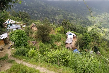
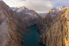
Aplicaciones de FutureWater
FutureWater utiliza SPHY para una gran variedad de estudios y aplicaciones hidrológicas:
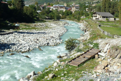
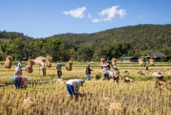
- Análisis del cambio hidrológico: Evaluación de regímenes hidrológicos pasados y futuros en proyectos como GIRH-Bhagirathi y GIRH-Tayikistán.
- Gestión de cuencas: Apoyo a la planificación estratégica de grandes cuencas fluviales, como la del Ganges.
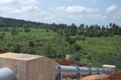
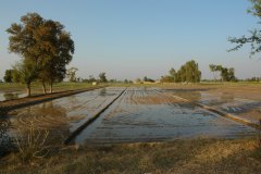
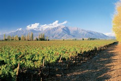
- Gestión del riego: Asesoramiento específico para explotaciones agrícolas, como en Rumanía y Angola.
- Previsión de caudales: Utilizada en la predicción operativa de caudales en Chile.
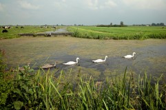
- Degradación y restauración del suelo: Aplicado en proyectos de gestión del paisaje como Madagascar.
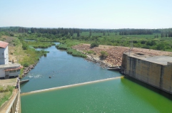
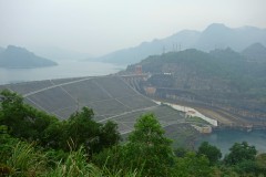
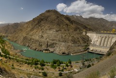
- Evaluaciones hidroeléctricas: Apoyo al desarrollo hidroeléctrico en Georgia, Indonesia, Kenia y otros lugares.
- Evaluación del riesgo de inundaciones: Evaluación del impacto de fenómenos meteorológicos extremos en proyectos como SYSTEM-RISK e IMPREX.
Más información en
Para más información, visite sphymodel.com.
Proyectos relacionados
-
MountAInWater: Reanálisis global de los recursos hídricos de montaña y los futuros puntos de inflexión
Las montañas suministran agua dulce a miles de millones de personas; sin embargo, nuestro conocimiento sobre cómo están respondiendo los glaciares, las capas de nieve y el permafrost al cambio climático sigue siendo incompleto, especialmente a escala global. Los puntos de inflexión críticos en la criósfera podrían alterar de manera...
-
SPHY QGIS Plugin for Hydrological Modeling
SPHY (Spatial Processes in Hydrology) is a conceptual, spatially distributed (raster-based) “leaky-bucket” type water balance model. Developed by FutureWater, with the support of national and international partners, SPHY has emerged as a robust, user-friendly tool for undertaking operational and strategic water resource management decisions. It stands out for its physical...
-
RoSPro: Roadside Spring Protection to Improve Water Security in Nepal
Las zonas de altitud media y alta del Himalaya se enfrentan a un grave problema de escasez de agua, lo que las convierte en una de las regiones más vulnerables del mundo. Los manantiales son salvavidas esenciales para millones de comunidades de montaña, ya que constituyen la principal fuente de...
-

Integrated Water Resources Management in Tajikistan
Given the abundant freshwater resources in Tajikistan, water plays a crucial role in the country's socioeconomic development. However, the rising population, economic growth, and the growing impacts of climate change pose significant challenges to ensure water availability and accessibility. This project aims to address the aforementioned information gap by improving...
-
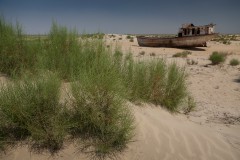
WE-ACT: Water Efficient Allocation in a Central Asian Transboundary River Basin
El objetivo general del proyecto WE-ACT es demostrar un sistema de apoyo a la toma de decisiones (DSS) para la asignación de agua en un río transfronterizo de Asia Central, con el fin de aumentar los beneficios compartidos y fomentar la adaptación de la gestión y planificación de los recursos...
-
SOS-Water: Water Resources System Safe Operating Space in a Changing Climate and Society
El objetivo del proyecto SOS-Water es establecer los límites dentro de los cuales la capacidad del paisaje para proporcionar servicios ecosistémicos no esté en peligro y la capacidad de la sociedad para adaptarse a los cambios ambientales no esté sobrecargada. Cruzar esos umbrales o puntos de inflexión en el complejo...
-

Development of a Glacio-Hydrological Model and IWRM Plan for the Uttarakhand subbasin in India
The Swiss Agency for Development and Cooperation’s (SDCs) Global Programme Climate Change and Environment (GP CCE) India is supporting the operationalization of climate change adaptation actions in the mountain states of Uttarakhand, Sikkim and Himachal Pradesh through the phase two of the “Strengthening State Strategies for Climate Action” (3SCA) project...
-
Hydrological Assessment for Hydropower in the Lukhra River
The objective was to develop a hydrological assessment for a planned run-of-river hydropower plant in the Lukhra river basin in Georgia. There is no observed river discharge data available. Hence, the assessment was developed based on hydrological simulations of the basin using the SPHY model (Terink et al., 2015) and...
-
Glacio-hydrological Assessment for Hydropower in the Nakhra River
The objective was to develop a glacio-hydrological assessment for planned run-of-river hydropower plant locations in the Nakhraa river basin in Georgia. The availability of observed river flow data is limited. Hence the assessment was developed based on hydrological simulations of the basin using the SPHY model (Terink et al., 2015)....
-

Training on Using Open Source Platforms for Hydrological Modelling of Data Sparse Regions in Nepal
This training was attended by sixteen researchers (seven female and nine male) from IOF, Department of Hydrology and Meteorology (DHM), Central Department of Hydrology and Meteorology (CDHM), Department of Forests and Soil Conservation and the Institute of Engineering (IOE). The overall objective of this training was to ensure the use...
-
Glacio-hydrological assessment for hydropower, Mestiachala river, Georgia
The objective of this project was to develop a hydrological assessment for two potential hydropower plant locations in the Mestiachala basin in Georgia. The availability of observed river discharge data is limited. Hence the assessment was developed based on hydrological simulations of the basin using the SPHY model (Terink et...
-
Improved catchment management for small hydropower
This study assessed the impacts of various investment portfolios for catchment management activities on the cost-benefits of small hydropower schemes, in two case study catchments in Kenya and Tanzania, and analyzes the return-on-investment for the hydropower developers. Catchment degradation trends, climate change impacts and socio-economic changes increasing competing water use...
-

Pan-TPE: Changes in the Pan-Third Pole Water Tower
The proposed research targets changes in climate, water supply and demand, and suitable adaptation measures for green development of the Silk Road Economic Belt (SREB) in the river basins crossed by the SREB transect. Given the strong role of large scale hydrology in the proposed research activities, the spatial domain...
-

Building Climate Change Resilience in Asia’s Critical Infrastructure
Critical infrastructure in South Asia and Southeast Asia needs to become more resilient to climate change. A Technical Assistance project, supported by Asian Development Bank (ADB), looks at three key sectors: transportation, transport and water. FutureWater is responsible for the assessment of the water sector which will aim to increase...
-

LAUREL: Land Use Planning for Enhanced Resilience of Landscapes
Deforestation, population growth, and climate change are only some of the challenges to sustainable landscape management in Madagascar. Severe impacts of land degradation on crop production, water availability and biodiversity are already observed and expected to exacerbate in the future. To address these challenges, the World Bank is supporting the...
-
Capacitación técnica en modelización de recursos hídricos para las agencias de gestión del agua de Mozambique
Se implementó un programa de capacitación teórico-práctica diseñada a medida para fortalecer el conocimiento del personal técnico de las agencias del agua de Mozambique (ARA) y fortalecer su capacidad para asesorar a los tomadores de decisión y políticos del agua. La capacitación abarcó los conceptos teóricos sobre modelado hidrológico y...
-
Hydropower Development Assessment for the Tamakoshi River Basin
The overall objective of this project is to improve the understanding of the expected impacts of climate change on water availability in the context of potential hydropower development in the Tamakoshi River Basin. Specifically, the project aims to (i) Understand the current baseline hydrological regime of the Tamakoshi River Basin,...
-
System-Risk: A large-scale systems approach to flood risk assessment and management
System-Risk is a Marie-Skłodowska-Curie European Training Network which aims on developing and implementing a systems approach for large-scale flood risk assessment and management and provides a framework for training and career development of 15 Early Stage Researchers (ESRs). In collaboration with the Royal Meteorological Institute (KNMI), FutureWater is the hosting...
-
Training in Water Resources and Allocation Models
A Tailor-Made Training was provided to three ARAs in Mozambique, being ARA-Centro (Beira), ARA-Centro-Norte (Nampula), and ARA-Norte (Pemba). The provided Tailor-Made Training focused on learning to work with a Water Resources and Water Allocation Model, and apply them to a catchment in Mozambique. Emphasis was put on how these tools...
-
Strategic Basin Planning Ganga River Basin
The World Bank has assigned Deltares and its partners AECOM India and FutureWater to carry out the project ”Analytical Work and Technical Assistance to support Strategic Basin Planning for Ganga River Basin in India”. The key objectives of this project are (i) Significantly strengthen the capability of relevant central and...
-
Inclusive Development Paths for Healthy Red River Landscapes
Rapid land use changes in the Red River Basin threaten water resources. This project will be working in the Day River Catchment, a Red River distributary important for Hanoi, where most of these problems are manifest. The project will develop equitable and economically viable pathways for the land and water...
-
Demonstration of Remote Sensing Information for Integrated Reservoir Management in the Red River Basin in Northern Vietnam
In 2011 the Vietnamese and Dutch government signed a Memorandum of Understanding on the establishment of a Government to Government (G2G) program for improved integrated planning and monitoring of water resources for transboundary water management and disaster risk management. This project was formulated as part of the G2G trajectory towards...
-

HI-AWARE: Himalayan Adaptation, Water and Resilience
HI-AWARE aims to contribute to enhanced adaptive capacities and climate resilience of the poor and vulnerable women, men, and children living in the mountains and flood plains of the Indus, Ganges, and Brahmaputra river basins. Research, including modeling, scoping studies, action research, and randomized control trials, is conducted at 12...
-
Central Asia Regional Risk Assessment for Water Related Energy Sector Impacts
The objective of this study was to support the “Central Asia Regional Energy Sector Vulnerability Study” led by Industrial Economics (IEc) and funded by the World Bank, by carrying out an expanded risk assessment for water availability and water related energy sector impacts in Central Asia. The work built on...
-
SWIMM: Soil Water evaluation system based on Integrated Measurements and Modelling
The main objective of the project was to support policy making, under current and future climate conditions, on optimal water management in nature reserve areas, based on uniform and consistent data collection. The project built upon knowledge developed under the “Klimaat voor Ruimte” framework and refined and demonstrated a method,...
-
Gridded Meteorological Datasets and Hydrological Modelling in the Upper Indus Basin
Understanding of the hydrological regimes in the mountainous Upper Indus basin (UIB) is essential for water resources management in the region. High-resolution gridded meteorological datasets, which capture the spatial variability of precipitation, are critical for modelling the hydrology of high-mountain regions. Improvements to existing gridded datasets using high-elevation station data...
-
INTOGENER: La integración de datos satelitales y modelos de previsión para aplicaciones energéticas
La necesidad de tener un pronóstico preciso a corto y mediano plazo de los caudales de rio generados por el deshielo en las cuencas de alta montaña es un componente importante para la gestión del agua y las actividades hidroeléctricas en varios ámbitos a escala global. Debido a la lejanía y el difícil acceso en...
-
Water Availability Analysis for the Upper Indus, Ganges and Brahmaputra River Basins
As part of the Himalayan Climate Change Adaptation Program (HICAP) ICIMOD has contracted FutureWater to generate climate change and water availability scenarios for the upstream parts of the Indus, Ganges and Brahmaputra river basins based on a high resolution hydrological model that FutureWater has developed.
-
Water and Adaptation Interventions in Central and West Asia
To assess the water resources availability in the Central Asia region under climate change hydrological models were developed for the two major rivers in the region, the Amu Darya and Syr Darya. Capacity building activities were undertaken to develop the capacity in each of the participating countries to use the...
-
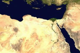
The Middle East and North Africa Regional Water Outlook
The Middle East and North Africa (MENA) region is considered the most water-scarce region of the world. Water investments absorb large amounts of public funds, which could often be used more efficiently elsewhere. The need for alternative and improved water management options is therefore urgently needed, but a clear overview...
-

Q Fever and Physical Environmental Factors
There are strong indications that the risk of infection in humans with Q fever depends on physical environmental factors such as warm weather with dry soils and a certain wind. In this study, the influence of these factors, soil type and, in particular, usage and humidity are examined, taking into...
-
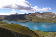
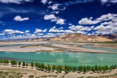
CEOP-AEGIS: Hydrology and meteorology of the Tibetan Plateau
This project delivered a prototype Water Balance Monitoring System (WBMS) and a three-year data set including observations of the water balance terms of the Tibetan Plateau on weekly and monthly basis. These observations contributed to clarifying the role of Plateau hydrology in the onset and intensity of the Asian Monsoon...