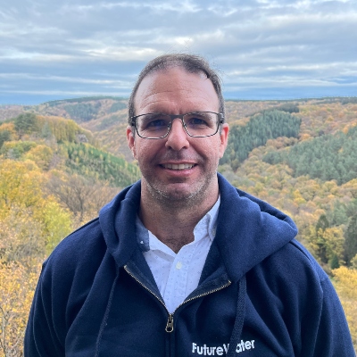
Licenciado en Ciencias Ambientales (2001) y Doctor por la Universidad de Almería (2005). Ecohidrólogo y experto en sequías y teledetección con más de 10 años de experiencia en investigación y consultoría en recursos hídricos (cuantificación de balances de agua y energía), modelización hidrológica y asignación de recursos, y uso de tecnologías geomáticas (imágenes de satélite-dron, y Sistemas de Información Geográfica). Estudia y cuantifica la interacción entre la Hidrosfera (dinámica hidrológica superficial y subterránea) y la Biosfera (funcionamiento de ecosistemas naturales y agrícolas), y cómo esta interacción es regulada y modificada por factores climáticos, eventos hidrometeorológicos extremos o las actividades humanas a diferentes escalas espaciales (parcela, paisaje, regional).
Ha sido investigador pre y postdoctoral del Consejo Superior de Investigaciones Científicas (España) (2002-2013), y ha realizado estancias en Australia (The University of Western Australia), Argentina (Instituto de Matemática Aplicada de San Luis) y EEUU (Bureau of Economic Geology). Ha participado en numerosos proyectos/contratos nacionales e internacionales. Se incorporó a FutureWater en 2013 liderando en la actualidad el desarrollo de InfoSequia, un servicio multiherramienta para la Gestión Integral de Sequías, y el paquete de trabajo de «Innovación y Sequías» en el proyecto europeo BRIGAID. Es socio numerario de la Asociación Internacional de Hidrogeólogos (IAH).
Proyectos relacionados
-
Climate Trends and Projections for Olive Production, Andalucia, Spain
The primary goal of this research is to examine the climatic changes projected for two key regions in Andalucia, Spain, which are deemed crucial for olive production. The study analyzes trends and future projections concerning rainfall, temperature, river flows, and evapotranspiration rates, discussing their potential impacts on both the micro...
-
Megasequías en Las Cuencas De Alta Montaña De Europa
Las megasequías son fenómenos raros y poco conocidos. Se definen como periodos de sequía excepcionalmente severos, carácter multianual y duración prolongada (>5 años), y que generan impactos extremos que afectan a grandes extensiones y diferentes sectores de la economía y del medio ambiente (Cook et al. (2022), Nat Rev Earth...
-
Catchment Assessment for Water Stewardship Plan
Highly productive berry farms and water scarcity are causing conflicts with the environmental assets and values of the Doñana National Park, Spain. There is growing interest in the agricultural sector to reverse this situation by implementing a water stewardship program. A catchment assessment is needed to produce baseline information to...
-
WEAP Ground Water Modelling in Mozambique
Groundwater availability is critical to the Umbeluzi Catchment. Currently, there is a need for a simple tool that can asses the availability of resources in the ground. This especially to asses the permits for groundwater extractions. It is expected that a simplified modelling approach can provide a trend analysis sufficient...
-
GLOW: Global Water Availability Forecasting Service to Support Water Security
The GLOW project aims to pilot an operational service that provides timely and easy access to current and forecasted water availability and demand across the entire Maputo River and the Black Umbeluzi River Basins.
-
MAGDA: Meteorological Assimilation from Galileo and Drones for Agriculture
The MAGDA project aims at providing an integrated – but modular – system to provide severe weather forecasts and irrigation advisories enhanced by means of various satellite-borne, drone-borne and ground-based weather-observing technologies. The main applications will be in providing both warnings about severe weather that could affect crops and irrigation...
-
SOS-Water: Water Resources System Safe Operating Space in a Changing Climate and Society
El objetivo del proyecto SOS-Water es establecer los límites dentro de los cuales la capacidad del paisaje para proporcionar servicios ecosistémicos no esté en peligro y la capacidad de la sociedad para adaptarse a los cambios ambientales no esté sobrecargada. Cruzar esos umbrales o puntos de inflexión en el complejo...
-
BONEX: Boosting Nexus Framework Implementation in the Mediterranean
BONEX is a project funded by the PRIMA-EU Foundation specifically for the Mediterranean Region. This region faces several challenges to ensure future food and water security, whilst preserving ecosystems. BONEX explores and develops specific solutions promoting the linking of governance with practice to overcome barriers to WEFE (water, energy, food,...
-
Groundwater Recharge in the Campo de Cartagena Quaternary Aquifer (SE Spain)
This project (1) provides a critical review of previous results generated, and a SWOT analysis of hydrological simulation tools used in the area. (2) improve and update the quantification of the main water balance components, including vertical and lateral fluxes, at the basin scale in recent times (2000-2020 period) through...
-
Water Risk Assessment for Private Farming in North Spain
This project aims to support a due diligence processs by reviewing and auditing water-related factors of risk for orchard fruit farming in including availibility and access, climate change impact, water quality, and potential conflicts and competence among water-demand users.
-
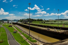
Metodología de Decisión Robusta aplicada a la ordenación del territorio de la cuenca del Canal de Panamá
A través de esta cooperación técnica, IDOM y FutureWater, bajo la supervisión del BID y la ACP, construirán el Plan Indicativo de Ordenamiento Territorial Ambiental (PIOTA) de la Cuenca del Canal de Panamá y definirán los instrumentos de gestión necesarios para su puesta en marcha. El PIOTA se rige como...
-
InfoSequia-4CAST: Forecasting and Quantifying Risks of Crop and Water Supply Failures Using Machine Learning and Remote Sensing
InfoSequia-4CAST combines historical and up-to-date observations of satellite-based meteorological and agricultural drought indices with climate variability indices, to generate seasonal outlooks of water supply and crop yield failure alerts. These impact-based indicators are computed using a simple, robust and easily understandable statistical forecasting-modelling framework. By making use of multi-sensor, state-of-the...
-
G3P: Development of a Global Gravity-based Groundwater Product
Groundwater is one of the most important freshwater resources for mankind and for ecosystems, and has been declared as an Essential Climate Variable (ECV) by GCOS, the Global Climate Observing System. However, the Copernicus Services do not yet deliver data on this fundamental resource, nor is there any other data...
-
Detection of On-farm Reservoirs in Irrigated Areas
The detection of on-site farm reservoirs and ponds in large areas is a complex task that can be addressed through the combination of visual inspection of orthophotos and the application of automatic pixel classification algorithms. This analysis performs a general workflow based on the usage of a Random Forest classifier...
-
Seguimiento operacional del estado de las praderas del Valle del Alagón mediante índices de satélite
Este proyecto se enmarca dentro de las actividades asistencia técnica que FutureWater provee al Grupo Operativo ECOPRADERAS. FutureWater tiene la encomienda de desarrollar una herramienta operacional para la evaluación del estado vegetativo de las praderas de la Vega del Alagón (Extremadura) mediante el seguimiento de indicadores satelitales y el análisis...
-
El Marco del Árbol de Decisión: Aplicación a la Cuenca de Chancay-Lambayeque, Perú
Para lograr mayores cuotas de seguridad hídrica y garantizar el uso sostenible de los recursos hídricos, en un contexto de reducción de disponibilidades de agua y aumento de demandas, se requieren inversiones en infraestructuras a escala de cuenca. Sin embargo, la existencia de una fuerte competitividad por el agua entre...
-
TWIGA: Transforming Weather Water data into value-added Information services for sustainable Growth in Africa
TWIGA aims to provide actionable geo-information on weather, water, and climate in Africa through innovative combinations of new in situ sensors and satellite-based geo-data. With the foreseen new services, TWIGA expects to reach twelve million people within the four years of the project, based on sustainable business models. The TWIGA...
-
HERMANA: Herramienta para el Manejo Integral del Agua
HERMANA (Herramienta para el Manejo Integral del Agua), tiene como objetivo fomentar el desarrollo de un Sistema Integrado de Apoyo a la Toma de Decisiones en materia de recursos hídricos, que facilite la toma de decisiones diarias, tácticas y estratégicas relacionadas con los recursos hídricos en Colombia, específicamente en la...
-
Cuantificación de la descarga subterránea al Mar Menor
La descarga subterránea procedente de los retornos de riego de origen agrícola hacia el Mar Menor se encuentra entre una de las posibles causas que explican los altos niveles de eutrofización (hipereutrofización) y elevada proliferación de algas alcanzados en este ecosistema lagunar. Una de las alternativas planteadas para reducir las...
-
IMPREX: Mejora en la predicción y gestión de los eventos hidrológicos extremos
IMPREX parte de la base de que mejorar la comprensión de los riesgos actuales es un punto de partida eficaz para adaptarse a los cambios futuros. Teniendo en consideración las posibles trayectorias climáticas y la experiencia obtenida a lo largo de un conjunto de sectores fuertemente dependientes del agua, IMPREX evaluará la efectividad de las...
-
Evaluación económica de las alternativas de gestión en los espacios naturales protegidos del Grupo de Acción Local Campoder
El Grupo de Acción Local (GAL) CAMPODER es una Asociación para el Desarrollo Rural que tiene como objetivo mantener programas, proyectos y actuaciones para el desarrollo integral y sostenible de su territorio. Las actuaciones comprenden acciones en el ámbito de la conservación y restauración del medio ambiente, la explotación y promoción de los recursos locales...
Publicaciones relacionadas
-
2024 - Technical report
Satellite-based Water Productivity of dominant croplands in the Jucar River Basin (Spain) by local implementation of WaPOR algorithm
Fernández-Rodríguez, A., S. Contreras, G. Simons
-
2024 - FutureWater Report
Hydrological Assessment, Risk Analysis and Farming Opportunities in the Doñana Ecosystem and the Coast of Huelva (Spain): AWS Catchment Status Report
Contreras, S., M. Bea, J.E. Hunink
-
2024 - Agricultural Water Management
How Future Changes in Irrigation Water Supply and Demand Affect Water Security in a Mediterranean Catchment
Eekhout, J.P.C., I. Delsman, J.E.M. Baartman, M. van Eupen, C. van Haren, S. Contreras, J. Martínez-López, J. de Vente
-
2024 - ESA-Incubed Project Final Report (FREP)
Infosequia-4CAST: Towards an Operational Satellite-based Drought Early Warning and Forecasting System for Quantifying Risks of Crop and Water Supply Failures
Contreras, S., G.W.H. Simons, A. Fernández-Rodríguez
-
2023 - Technical report
MAGDA: Water Balance Simulations
Verschuren, L., A. Fernández, M. de Klerk, S. Contreras, E. Aparicio Medrano
-
2023 - FutureWater Report 234
InfoSequia-4CAST: Water Supply Pilot Case
Contreras, S., A. Fernández, J.E. Hunink, G.W.H. Simons
-
2023 - FutureWater Report 235
InfoSequia-4CAST: Crop Yield Pilot Case
Contreras, S., A. Fernández, A. Grudnowska, M. Wens, G.W.H. Simons
-
2023 - Technical report
Historical and Recent Patterns of Groundwater Recharge in the Campo De Cartagena Quaternary Aquifer by Combining Hydrological Modelling and Satellite Data
Contreras, S., J.L. García-Aróstegui, V. Robles-Arenas, J.E. Hunink
-
2023 - Technical report
G3P-GDI InfoSequia Integration and Evaluation Report
Contreras, S., A. Fernández
-
2023 - Technical report
G3P Evaluation Report
Urgilez-Vinueza, A., C. Ruz-Vargas, S. Contreras, T. Imran
-
2022 - FutureWater Report 234
InfoSequia-4CAST: Report on InfoSequia-4CAST Development
Contreras, S., G. Guimarães, A. Fernández, S. Khanal, G.W.H. Simons
-
2022 - FutureWater Report 235
InfoSequia-4CAST: Report on InfoSequia Monitor Upgrading
Contreras, S., C. Nolet, S. Khanal, A. Fernández, G.W.H. Simons
-
2021 - FutureWater Report 230
InfoSequia-4CAST: Risk Assessment and Mitigation Plan
Contreras, S., G.W.H. Simons, A. Fernández
-
2021 - FutureWater Report 229
InfoSequia-4CAST: Action Plan for Developing and Testing
Contreras, S., A. Fernández, G. Guimarães, G.W.H. Simons
-
2021 - FutureWater Report 228
InfoSequia-4CAST: Baseline Design Report
Contreras, S., G. Guimarães, G.W.H. Simons, C. Nolet, J.Beard, S. Khanal, A. Fernández
-
2021 - Technical Report
Plan Indicativo de Ordenamiento Territorial Ambiental (PIOTA) para la Cuenca Hidrográfica del Canal de Panamá (CHCP)
FutureWater - IDOM
-
2020 - Internship report
Determining the dryness index and evaporative fraction for satellite and drone images
Faassen, K., C. Nolet, S. Contreras
-
2020 - FutureWater Report 212
Monitor Ecopraderas: Seguimiento del estado de las praderas de la Vega del Alagón mediante indicadores de satélite
Contreras, S., C. Nolet, G.W.H. Simons
-
2019 - FutureWater Report 197
Seasonal Hydrological Forecasting for the Segura River Basin, Spain
Hamed, R., A. De Tomas, S. Contreras, J.E. Hunink
-
2019 - BRIGAID Internal Report
InfoSequia Testing Development Report
Contreras, S., J.E. Hunink
-
2019 - FutureWater Report 186
Detection and coverage estimation of on-farm reservoirs and ponds in Mediterranean irrigated regions using orthophotos and pixel classification techniques
Contreras, S.
-
2019 - E-Proceedings of the 38th IAHR World Congress
HERMANA: Co-Design of an Integrated Operational Water Management Tool For the Valle Del Cauca, Colombia
Ball, S., M.F. Sanchez, M. Werner, S.T. Escobar Carmona, C.Y. Soto Chavez, M. Wuis, S. Contreras, K. Douben, M. Visser, J.E. Hunink
-
2019 - Water
A Simplified Water Accounting Procedure to Assess Climate Change Impact on Water Resources for Agriculture across Different European River Basins
Hunink, J.E, G.W.H. Simons, S. Suárez-Almiñana, A. Solera, J. Andreu, M. Giuliani, P. Zamberletti, M. Grillakis, A. Koutroulis, I. Tsanis, F. Schasfoort, S. Contreras, E. Ercin, W. Bastiaanssen
-
2019 - Technical Report
El Marco del Árbol de Decisión: Aplicación a la Cuenca de Chancay-Lambayeque, Peru
Taner M.Ü., J.E. Hunink, S. Contreras, A. Hijar, R. Hamed, D. Morales, A. Wasti, P. Ray
-
2019 - FutureWater Report 194
Satellite-based altimetry data for hydrological assessments: two case studies
Hunink, J.E., J.P.C. Eekhout, J. de Vente, S. Contreras, G.W.H. Simons
-
2019 - Science of the Total Environment
Hydrogeological modelling for the watershed management of the Mar Menor coastal lagoon (Spain)
Alcolea, A., S. Contreras, J.E. Hunink, J.L. García-Aróstegui, J. Jiménez-Martínez
-
2018 - Agricultural Water Management
Comparison of meteorological and satellite-based drought indices as yield predictors of Spanish cereals
García-León, D., S. Contreras, J.E. Hunink
-
2017 - FutureWater Report 176
Cuantificación de la descarga subterránea al Mar Menor mediante modelización hidrogeológica del acuífero superficial Cuaternario
Contreras, S., A. Alcolea, J. Jiménez-Martínez, J.E. Hunink
-
2017 - FutureWater Report 174
Water and carbon fluxes in irrigated citrus orchards assessed from satellite data
Contreras, S., J.E. Hunink, A. Baille
-
2017 - Remote Sensing
Hydrological Modelling using Satellite-Based Crop Coefficients: A Comparison of Methods at the Basin Scale
Hunink J.E., J.P.C. Eekhout, J. de Vente, S. Contreras, P. Droogers, A. Baille
-
2017 - FutureWater Report 167
Hydrological Evaluation and Ecosystem Valuation of the Lukanga Swamps
Hunink, J.E., S. Contreras, G.W.H. Simons, P. Droogers
-
2016 - Agricultural Water Management
Effects of saline reclaimed waters and deficit irrigation on Citrusphysiology assessed by UAV remote sensing
Romero-Triguerosa, C., P.A. Nortes, J.J. Alarcón, J.E. Hunink, M. Parra, S. Contreras, P. Droogers, E. Nicolás
-
2016 - Environmental Reviews
The role of groundwater in highly human-modified hydrosystems: a review of impacts and mitigation options in the Campo de Cartagena-Mar Menor coastal plain (SE Spain)
Jimenez-Martinez, J., J.L. Garcia-Arostegui, J.E. Hunink, S. Contreras, P. Baudron, L. Candela
-
2016 - Journal of Hydrology and Hydromechanics
Vertical and lateral soil moisture patterns on a mediterranean karst hillslope
Cantón, Y., E. Rodríguez-Caballero, S. Contreras, L. Villagarcía, X.Y. Li, A. Solé-Benet, F. Domingo
-
2015 - Agricultural Water Management
Estimating groundwater use patterns of perennial and seasonal crops in a Mediterranean irrigation scheme, using remote sensing
Hunink, J.E., S. Contreras, M. Soto-García, B. Martin-Gorriz, V. Martinez-Álvarez, A. Baille
-
2015 - FutureWater Report 148
Scoping Assessment of Erosion Levels for the Mahale region, Lake Tanganyika, Tanzania
Hunink, J.E., W. Terink, S. Contreras, P. Droogers
-
2015 - FutureWater Report 138
Water accounting at the basin scale: water use and supply (2000-2010) in the Segura River Basin using the SEEA framework
Contreras, S., J.E. Hunink
-
2015 - FutureWater Report 141
Hydrological pre-feasibility assessment for the Romuku hydropower plant Central Sulawesi, Indonesia
Hunink, J.E., S. Contreras, P. Droogers
-
2014 - Water Environment Research
Effects of reclaimed waters on spectral properties and leaf traits of Citrus orchards
Contreras, S., P. Pérez-Cutillas, C.S. Santoni, C. Romero-Trigueros, F. Pedrero, J.J. Alarcón
-
2014 - Droughts: Research and Science-Policy Interfacing
Drought effects on rainfed agriculture using standardized indices: A case study in SE Spain
Contreras, S., J.E. Hunink
-
2014 - FutureWater Report 125
Building a Watershed Information System for the Campo de Cartagena basin (Spain) integrating hydrological modeling and remote sensing
Contreras, S., J.E. Hunink, A. Baille
-
2013 - Earth observation of ecosystem services
Detecting ecosystem reliance on groundwater based on satellite-derived greenness anomaly and temporal dynamics
Contreras, S., D. Alcaraz-Segura, B. Scanlon, E.G. Jobbágy
-
2013 - Ecohydrology
Abrupt watercourse formation in a semiarid sedimentary landscape of central Argentina: The roles of forest clearing, rainfall variability, and seismic activity
Contreras, S., C.S. Santoni, E.G. Jobbagy
-
2012 - Plant, Cell and Environment
Stand structure modulates the long-term vulnerability of Pinus halepensis to climatic drought in a semiarid Mediterranean ecosystem
Moreno-Gutierrez, C., G. Battipaglia, P. Cherebuni, M. Saurer, E. Nicolás, S. Contreras, J.I. Querejeta
-
2011 - Environmental Earth Sciences
Diffuse and concentrated recharge evaluation using physical and tracer techniques: Results from a semiarid carbonate massif aquifer in southeastern Spain
Alcalá, F.J., Y. Cantón, S. Contreras, A. Were, P. Serrano-Ortiz, J. Puigdefábregas, A. Solé-Benet, E. Custodio, F. Domingo
-
2011 - Catena
Controls of infiltration-runoff processes in Mediterranean karst rangelands in SE Spain
Li, X-Y., S. Contreras, A. Solé-Benet, Y. Cantón, F. Domingo, R. Lázaro, H. Lin, B. Van Wesemael, J. Puigdefábregas
-
2011 - Journal of Hydrology
Remote sensing estimates of supplementary water consumption by arid ecosystems of central Argentina
Contreras, S., E.G. Jobbagy, P.E. Villagra, M.D. Nosetto, J. Puigdefábregas
-
2010 - Water Resources Research
Vadose zone transport in dry forests of central Argentina: The role of land use
Santoni, C.S., E.G. Jobbagy, S. Contreras


